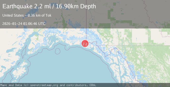
Earthquake 110 km NW of Yakutat, Alaska
Sat, 24 Jan 2026 01:06:46 GMT
Time3 days ago
Location
60.1910, -141.2240
Depth
16.9 KM
Event Summary
A 2.2 magnitude earthquake struck on 110 km NW of Yakutat, Alaska, at Sat, 24 Jan 2026 01:06:46 GMT. Depth: 16.9km. Reviewed by USGS seismologists, this minor quake occurred at a magnitude type of ml.
Magnitude
2.2
ml
Source
USGS
Intensity
-
Agency Reports
1 Sources| Source | Magnitude | Depth | Time |
|---|---|---|---|
| USGSPrimary | 2.2 | 17 km | 3 days ago |
Earthquake Details
AutomaticEvent IDusgs_ak2026bqhxuh
Tsunami PotentialNo
Magnitude Typeml
Nearest Places
- Coal Glacier2.4 km
- Daisy Glacier3.1 km
- Tyndall Glacier4.5 km
- Karr Hills6.1 km
- Hoof Hill6.4 km
Comments
Join the discussion about this event.
Latest Earthquakes
2.6Mag
Minahassa Peninsula, Sulawesi
Time3 minutes ago
Depth10.00 km
SourceBMKG (Automatic)
1.1Mag
30 km NE of Los Alamos, CA
Time13 minutes ago
Depth4.17 km
SourceUSGS (Automatic)
1.2Mag
EASTERN TURKEY
Time13 minutes ago
Depth7.00 km
SourceAFAD (Automatic)
2.6Mag
Timor Region
Time16 minutes ago
Depth35.26 km
SourceBMKG (Automatic)
2.3Mag
Sumbawa Region, Indonesia
Time16 minutes ago
Depth10.00 km
SourceBMKG (Automatic)
Nearby Earthquakes
0.8Mag
120 km NW of Yakutat, Alaska
Time3 days ago
Depth5.00 km
SourceUSGS (Automatic)
1.0Mag
127 km NW of Yakutat, Alaska
Time19 hours ago
Depth19.90 km
SourceUSGS (Automatic)
2.1Mag
111 km WNW of Yakutat, Alaska
Time3 days ago
Depth8.00 km
SourceUSGS (Automatic)
2.6Mag
96 km WNW of Yakutat, Alaska
Time5 days ago
Depth4.10 km
SourceUSGS (Automatic)
1.6Mag
102 km NW of Yakutat, Alaska
Time1 day ago
Depth15.10 km
SourceUSGS (Automatic)