Earthquake 124 km SE of Ugashik, Alaska
Mon, 02 Feb 2026 06:40:43 GMT
Time16 hours ago
Location
56.6100, -156.1760
Depth
67.8 KM
Event Summary
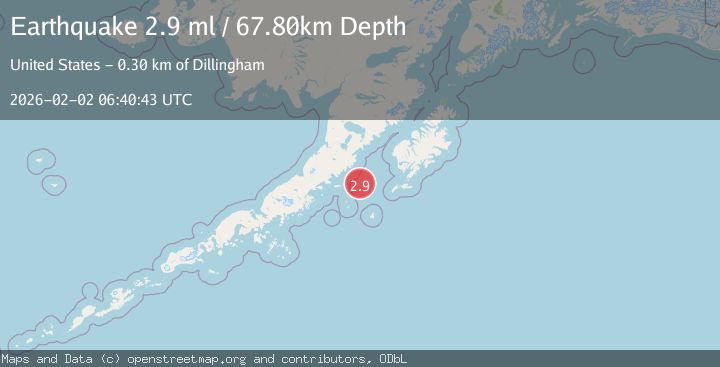
A 2.9 magnitude earthquake struck on 124 km SE of Ugashik, Alaska, at Mon, 02 Feb 2026 06:40:43 GMT. Depth: 67.8km. Reviewed by USGS seismologists, this minor quake occurred at a magnitude type of ml.
Magnitude
2.9
ml
Source
USGS
Intensity
-
Agency Reports
1 Sources| Source | Magnitude | Depth | Time |
|---|---|---|---|
| USGSPrimary | 2.9 | 68 km | 16 hours ago |
Earthquake Details
AutomaticEvent IDusgs_ak2026chgnmm
Tsunami PotentialNo
Magnitude Typeml
Nearest Places
- Aiugnak Columns39.1 km
- Devils Finger39.7 km
- Radial Island42.4 km
- Toee Reef44.5 km
- Navy Island45.9 km
Comments
Join the discussion about this event.
Latest Earthquakes
2.9Mag
Timor Region
Time17 hours ago
Depth10.50 km
SourceBMKG (Automatic)
1.7Mag
32 km S of Rachel, Nevada
Time17 hours ago
Depth0.83 km
SourceUSGS (Automatic)
1.7Mag
7 km NW of Delta, B.C., MX
Time17 hours ago
Depth5.86 km
SourceUSGS (Automatic)
0.9Mag
5 km NW of The Geysers, CA
Time17 hours ago
Depth3.47 km
SourceUSGS (Automatic)
1.1Mag
3 km NNW of Fontana, CA
Time17 hours ago
Depth6.45 km
SourceUSGS (Automatic)
Nearby Earthquakes
2.5Mag
112 km SE of Ugashik, Alaska
Time1 week ago
Depth51.20 km
SourceUSGS (Automatic)
3.9Mag
113 km SSE of Ugashik, Alaska
Time1 week ago
Depth45.10 km
SourceUSGS
2.7Mag
120 km E of Chignik, Alaska
Time1 week ago
Depth42.50 km
SourceUSGS (Automatic)
1.9Mag
62 km WSW of Karluk, Alaska
Time1 week ago
Depth59.00 km
SourceUSGS (Automatic)
2.8Mag
23 km W of Akhiok, Alaska
Time3 days ago
Depth0.60 km
SourceUSGS (Automatic)