Earthquake 32 km S of Rachel, Nevada
Mon, 02 Feb 2026 06:04:01 GMT
Time17 hours ago
Location
37.3487, -115.7369
Depth
0.8 KM
Event Summary
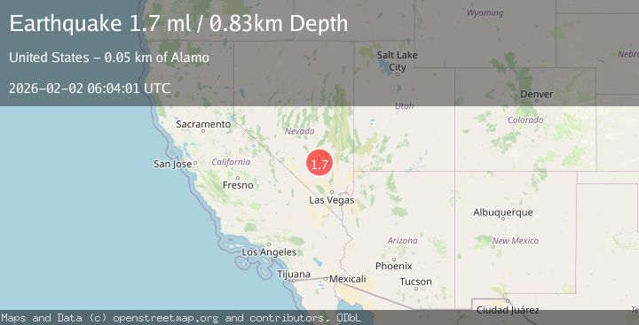
A 1.7 magnitude earthquake struck on 32 km S of Rachel, Nevada, at Mon, 02 Feb 2026 06:04:01 GMT. Depth: 0.8285km. Reviewed by USGS seismologists, this minor quake occurred at a magnitude type of ml.
Magnitude
1.7
ml
Source
USGS
Intensity
-
Agency Reports
1 Sources| Source | Magnitude | Depth | Time |
|---|---|---|---|
| USGSPrimary | 1.7 | 1 km | 17 hours ago |
Earthquake Details
AutomaticEvent IDusgs_nn00910296
Tsunami PotentialNo
Magnitude Typeml
Nearest Places
- Groom Mining District2.2 km
- Groom Mine2.6 km
- Mount Wandell3.1 km
- Black Metal Mine3.4 km
- Cane Spring4.2 km
Comments
Join the discussion about this event.
Latest Earthquakes
2.2Mag
7 km S of Badger, Alaska
Time4 minutes ago
Depth19.20 km
SourceUSGS (Automatic)
1.9Mag
87 km N of Yakutat, Alaska
Time17 minutes ago
Depth5.00 km
SourceUSGS (Automatic)
1.8Mag
44 km NW of Tatitlek, Alaska
Time21 minutes ago
Depth17.80 km
SourceUSGS (Automatic)
2.3Mag
Flores Region, Indonesia
Time21 minutes ago
Depth17.19 km
SourceBMKG (Automatic)
3.6Mag
Sumbawa Region, Indonesia
Time23 minutes ago
Depth14.84 km
SourceBMKG (Automatic)
Nearby Earthquakes
2.3Mag
NEVADA
Time6 days ago
Depth9.80 km
SourceNN (Automatic)
2.5Mag
23 km SSE of Rachel, Nevada
Time1 day ago
Depth9.40 km
SourceUSGS (Automatic)
1.6Mag
11 km NNW of Alamo, Nevada
Time2 days ago
Depth15.82 km
SourceUSGS (Automatic)
1.7Mag
7 km ESE of Hiko, Nevada
Time5 days ago
Depth14.08 km
SourceUSGS (Automatic)
1.8Mag
40 km SE of Goldfield, Nevada
Time9 hours ago
Depth7.60 km
SourceUSGS (Automatic)