Earthquake 14 km N of Four Mile Road, Alaska
Sun, 08 Feb 2026 09:00:53 GMT
Time1 hour ago
Location
64.7310, -149.0710
Depth
5.5 KM
Event Summary
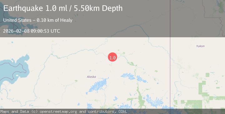
A 1.0 magnitude earthquake struck on 14 km N of Four Mile Road, Alaska, at Sun, 08 Feb 2026 09:00:53 GMT. Depth: 5.5km. Reviewed by USGS seismologists, this minor quake occurred at a magnitude type of ml.
Magnitude
1.0
ml
Source
USGS
Intensity
-
Agency Reports
1 Sources| Source | Magnitude | Depth | Time |
|---|---|---|---|
| USGSPrimary | 1.0 | 6 km | 1 hour ago |
Earthquake Details
AutomaticEvent IDusgs_ak2026cslnoe
Tsunami PotentialNo
Magnitude Typeml
Nearest Places
- Sawmill Island3.0 km
- Soldier Slough4.1 km
- Linder Lakes6.8 km
- Nunivak Slough7.9 km
- Totchaket Slough8.3 km
Comments
Join the discussion about this event.
Latest Earthquakes
4.4Mag
Banda Sea
Time5 minutes ago
Depth171.27 km
SourceBMKG (Automatic)
3.2Mag
South of Sumbawa, Indonesia
Time8 minutes ago
Depth10.00 km
SourceBMKG (Automatic)
1.5Mag
12 km SSE of Anza, CA
Time12 minutes ago
Depth9.54 km
SourceUSGS (Automatic)
2.2Mag
Sumbawa Region, Indonesia
Time22 minutes ago
Depth24.20 km
SourceBMKG (Automatic)
3.0Mag
CHIAPAS, MEXICO
Time27 minutes ago
Depth5.20 km
SourceUNM (Automatic)
Nearby Earthquakes
1.2Mag
19 km NNE of Four Mile Road, Alaska
Time3 hours ago
Depth5.00 km
SourceUSGS (Automatic)
1.3Mag
20 km NNE of Four Mile Road, Alaska
Time1 week ago
Depth5.00 km
SourceUSGS (Automatic)
2.2Mag
8 km N of Four Mile Road, Alaska
Time1 week ago
Depth19.90 km
SourceUSGS (Automatic)
0.8Mag
14 km NNW of Four Mile Road, Alaska
Time1 week ago
Depth19.30 km
SourceUSGS (Automatic)
0.8Mag
4 km NNW of Four Mile Road, Alaska
Time1 week ago
Depth19.10 km
SourceUSGS (Automatic)