Earthquake 48 km ESE of McCarthy, Alaska
Sun, 15 Feb 2026 20:08:44 GMT
Time3 days ago
Location
61.3270, -142.0490
Depth
74.1 KM
Event Summary
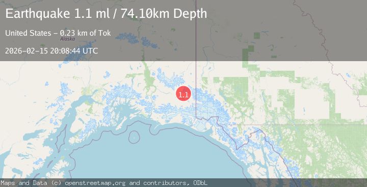
A 1.1 magnitude earthquake struck on 48 km ESE of McCarthy, Alaska, at Sun, 15 Feb 2026 20:08:44 GMT. Depth: 74.1km. Reviewed by USGS seismologists, this minor quake occurred at a magnitude type of ml.
Magnitude
1.1
ml
Source
USGS
Intensity
-
Agency Reports
1 Sources| Source | Magnitude | Depth | Time |
|---|---|---|---|
| USGSPrimary | 1.1 | 74 km | 3 days ago |
Earthquake Details
AutomaticEvent IDusgs_ak2026dgdtgd
Tsunami PotentialNo
Magnitude Typeml
Nearest Places
- Celeno Peak4.5 km
- Twaharpies Glacier4.8 km
- Ocypete Peak6.0 km
- The Twaharpies6.0 km
- Aello Peak9.1 km
Comments
Join the discussion about this event.
Latest Earthquakes
2.5Mag
Bering Strait
Time4 minutes ago
Depth200.07 km
SourceVYT (Automatic)
2.3Mag
Sumbawa Region, Indonesia
Time4 minutes ago
Depth10.00 km
SourceBMKG
1.6Mag
13 km ENE of Falls City, Texas
Time14 minutes ago
Depth7.18 km
SourceUSGS (Automatic)
1.5Mag
EASTERN TURKEY
Time17 minutes ago
Depth7.00 km
SourceAFAD (Automatic)
1.3Mag
5 km S of Cabazon, CA
Time17 minutes ago
Depth5.80 km
SourceUSGS (Automatic)
Nearby Earthquakes
1.2Mag
47 km ESE of McCarthy, Alaska
Time6 hours ago
Depth4.30 km
SourceUSGS (Automatic)
1.2Mag
56 km E of McCarthy, Alaska
Time1 week ago
Depth5.00 km
SourceUSGS (Automatic)
0.9Mag
Southern Alaska
Time2 days ago
Depth3.54 km
SourceVYT (Automatic)
1.2Mag
68 km E of McCarthy, Alaska
Time3 weeks ago
Depth5.00 km
SourceUSGS (Automatic)
0.8Mag
Southern Alaska
Time5 days ago
Depth15.87 km
SourceVYT (Automatic)