Earthquake 45 km SW of Karluk, Alaska
Tue, 17 Feb 2026 17:33:40 GMT
Time18 hours ago
Location
57.2510, -154.9240
Depth
60.6 KM
Event Summary
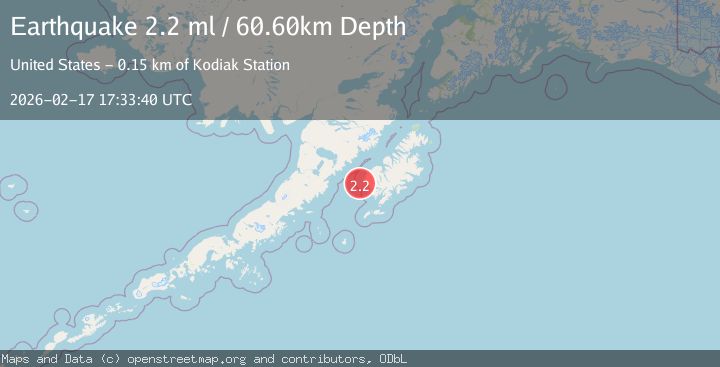
A 2.2 magnitude earthquake struck on 45 km SW of Karluk, Alaska, at Tue, 17 Feb 2026 17:33:40 GMT. Depth: 60.6km. Reviewed by USGS seismologists, this minor quake occurred at a magnitude type of ml.
Magnitude
2.2
ml
Source
USGS
Intensity
-
Agency Reports
1 Sources| Source | Magnitude | Depth | Time |
|---|---|---|---|
| USGSPrimary | 2.2 | 61 km | 18 hours ago |
Earthquake Details
AutomaticEvent IDusgs_ak2026djqbit
Tsunami PotentialNo
Magnitude Typeml
Nearest Places
- Outer Seal Rock7.6 km
- Seal Rocks8.3 km
- Inner Seal Rock8.3 km
- Ikolik (historical)9.4 km
- Cape Ikolik9.6 km
Comments
Join the discussion about this event.
Latest Earthquakes
3.3Mag
Papua, Indonesia
Time18 hours ago
Depth3.17 km
SourceVYT (Automatic)
2.4Mag
Tarapaca, Chile
Time18 hours ago
Depth86.91 km
SourceVYT (Automatic)
1.1Mag
86 km NNW of Karluk, Alaska
Time18 hours ago
Depth5.00 km
SourceUSGS (Automatic)
2.6Mag
Antofagasta, Chile
Time18 hours ago
Depth0.00 km
SourceVYT (Automatic)
2.3Mag
Poland
Time18 hours ago
Depth0.00 km
SourceVYT (Automatic)
Nearby Earthquakes
3.0Mag
KODIAK ISLAND REGION, ALASKA
Time5 years ago
Depth1.00 km
SourceNEIC (Automatic)
3.0Mag
ALASKA PENINSULA
Time8 years ago
Depth60.00 km
SourceEMSC (Automatic)
3.0Mag
KODIAK ISLAND REGION, ALASKA
Time4 years ago
Depth6.00 km
SourceNEIR (Automatic)
5.1Mag
ALASKA PENINSULA
Time4 years ago
Depth68.00 km
SourceEMSC (Automatic)
5.2Mag
ALASKA PENINSULA
Time19 years ago
Depth53.00 km
SourceEMSC (Automatic)