Earthquake 15 km N of Warner Springs, CA
Sat, 17 Jan 2026 16:17:00 GMT
Time2 hours ago
Location
33.4162, -116.6423
Depth
6.7 KM
Event Summary
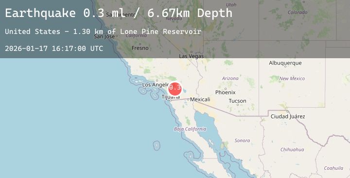
A 0.3 magnitude earthquake struck on 15 km N of Warner Springs, CA, at Sat, 17 Jan 2026 16:17:00 GMT. Depth: 6.67km. Reviewed by USGS seismologists, this minor quake occurred at a magnitude type of ml.
Magnitude
0.3
ml
Source
USGS
Intensity
-
Agency Reports
1 Sources| Source | Magnitude | Depth | Time |
|---|---|---|---|
| USGSPrimary | 0.3 | 7 km | 2 hours ago |
Earthquake Details
AutomaticEvent IDusgs_ci41160455
Tsunami PotentialNo
Magnitude Typeml
Nearest Places
- Lone Pine Reservoir1.3 km
- Twin Lakes2.3 km
- Cooper Cienega3.7 km
- Twin Lakes3.7 km
- Combs Peak4.2 km
Comments
Join the discussion about this event.
Latest Earthquakes
2.2Mag
Sumbawa Region, Indonesia
Time50 minutes ago
Depth25.48 km
SourceBMKG (Automatic)
2.2Mag
Northern Sumatra, Indonesia
Time57 minutes ago
Depth4.35 km
SourceBMKG (Automatic)
1.8Mag
16 km S of Volcano, Hawaii
Time1 hour ago
Depth0.45 km
SourceUSGS (Automatic)
5.4Mag
SOUTH SANDWICH ISLANDS REGION
Time1 hour ago
Depth68.50 km
SourceNEIC (Automatic)
2.5Mag
CENTRAL TURKEY
Time1 hour ago
Depth6.20 km
SourceEMSC (Automatic)
Nearby Earthquakes
0.5Mag
18 km N of Borrego Springs, CA
Time4 hours ago
Depth13.44 km
SourceUSGS (Automatic)
1.2Mag
17 km ESE of Anza, CA
Time10 hours ago
Depth13.97 km
SourceUSGS (Automatic)
1.8Mag
5 km SSW of Idyllwild, CA
Time11 hours ago
Depth17.31 km
SourceUSGS (Automatic)
0.9Mag
16 km ESE of Anza, CA
Time13 hours ago
Depth12.52 km
SourceUSGS (Automatic)
1.1Mag
15 km SE of Anza, CA
Time17 hours ago
Depth9.75 km
SourceUSGS (Automatic)