Earthquake 17 km ESE of Anza, CA
Sat, 17 Jan 2026 08:32:27 GMT
Time1 hour ago
Location
33.5072, -116.4942
Depth
14.0 KM
Event Summary
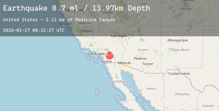
A 1.2 magnitude earthquake struck on 17 km ESE of Anza, CA, at Sat, 17 Jan 2026 08:32:27 GMT. Depth: 13.97km. Reviewed by USGS seismologists, this minor quake occurred at a magnitude type of ml.
Magnitude
1.2
ml
Source
USGS
Intensity
-
Agency Reports
3 Sources| Source | Magnitude | Depth | Time |
|---|---|---|---|
| USGSPrimary | 0.7 | 14 km | 1 hour ago |
| USGSPrimary | 1.2 | 12 km | 1 hour ago |
| USGSPrimary | 0.7 | 16 km | 1 hour ago |
Earthquake Details
AutomaticEvent IDusgs_ci41160287
Tsunami PotentialNo
Magnitude Typeml
Nearest Places
- Garnet Queen Creek3.5 km
- Medicine Canyon3.7 km
- Mountain Home Spring3.7 km
- Santa Rosa Spring Campground4.0 km
- Idyllwild4.1 km
Comments
Join the discussion about this event.
Latest Earthquakes
2.9Mag
Sumba Region, Indonesia
Time15 minutes ago
Depth43.65 km
SourceBMKG (Automatic)
2.7Mag
Timor Region
Time20 minutes ago
Depth63.53 km
SourceBMKG (Automatic)
1.6Mag
40 km NW of Valdez, Alaska
Time23 minutes ago
Depth23.30 km
SourceUSGS (Automatic)
1.4Mag
7 km NW of The Geysers, CA
Time25 minutes ago
Depth0.99 km
SourceUSGS (Automatic)
3.6Mag
CENTRAL ALASKA
Time32 minutes ago
Depth0.00 km
SourceAK (Automatic)
Nearby Earthquakes
1.8Mag
5 km SSW of Idyllwild, CA
Time3 hours ago
Depth17.31 km
SourceUSGS (Automatic)
0.9Mag
16 km ESE of Anza, CA
Time5 hours ago
Depth12.52 km
SourceUSGS (Automatic)
1.1Mag
15 km SE of Anza, CA
Time8 hours ago
Depth9.75 km
SourceUSGS (Automatic)
1.7Mag
11 km W of Pine Valley, CA
Time10 hours ago
Depth16.96 km
SourceUSGS (Automatic)
0.5Mag
6 km SW of Warner Springs, CA
Time11 hours ago
Depth6.71 km
SourceUSGS (Automatic)