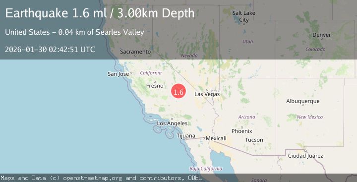
Earthquake 13 km ENE of Ridgecrest, CA
Fri, 30 Jan 2026 02:32:27 GMT
Time8 hours ago
Location
35.6845, -117.5572
Depth
7.8 KM
Event Summary
A 1.6 magnitude earthquake struck on 13 km ENE of Ridgecrest, CA, at Fri, 30 Jan 2026 02:32:27 GMT. Depth: 7.78000020980835km. Reviewed by USGS seismologists, this minor quake occurred at a magnitude type of ml.
Magnitude
1.6
ml
Source
USGS
Intensity
-
Agency Reports
1 Sources| Source | Magnitude | Depth | Time |
|---|---|---|---|
| USGSPrimary | 1.6 | 3 km | 8 hours ago |
Earthquake Details
AutomaticEvent IDusgs_ci41176055
Tsunami PotentialNo
Magnitude Typeml
Nearest Places
- Trona Water Pipeline2.1 km
- Lone Butte4.3 km
- Lark Seep5.3 km
- Salt Wells Valley5.5 km
- Skytop5.6 km
Comments
Join the discussion about this event.
Latest Earthquakes
1.1Mag
12 km ENE of Desert Hot Springs, CA
Time4 minutes ago
Depth5.24 km
SourceUSGS (Automatic)
2.6Mag
Sumbawa Region, Indonesia
Time5 minutes ago
Depth32.31 km
SourceBMKG (Automatic)
1.1Mag
SLOVENIA
Time12 minutes ago
Depth0.00 km
SourceOGS (Automatic)
3.3Mag
ANTOFAGASTA, CHILE
Time15 minutes ago
Depth104.10 km
SourceCSN (Automatic)
1.4Mag
WESTERN TURKEY
Time22 minutes ago
Depth7.00 km
SourceAFAD (Automatic)
Nearby Earthquakes
1.3Mag
11 km ENE of Ridgecrest, CA
Time1 day ago
Depth3.18 km
SourceUSGS (Automatic)
1.3Mag
15 km NE of Ridgecrest, CA
Time4 days ago
Depth10.03 km
SourceUSGS (Automatic)
1.1Mag
12 km ENE of Ridgecrest, CA
Time6 days ago
Depth6.28 km
SourceUSGS (Automatic)
1.3Mag
Central California
Time1 week ago
Depth8.95 km
SourceUSGS (Automatic)
1.4Mag
15 km ENE of Ridgecrest, CA
Time3 days ago
Depth7.69 km
SourceUSGS (Automatic)