Earthquake 10 km SSW of Idyllwild, CA
Fri, 06 Feb 2026 14:33:26 GMT
Time1 hour ago
Location
33.6570, -116.7613
Depth
12.9 KM
Event Summary
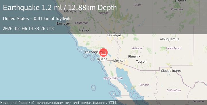
A 1.2 magnitude earthquake struck on 10 km SSW of Idyllwild, CA, at Fri, 06 Feb 2026 14:33:26 GMT. Depth: 12.8800001144409km. Reviewed by USGS seismologists, this minor quake occurred at a magnitude type of ml.
Magnitude
1.2
ml
Source
USGS
Intensity
-
Agency Reports
1 Sources| Source | Magnitude | Depth | Time |
|---|---|---|---|
| USGSPrimary | 1.2 | 13 km | 1 hour ago |
Earthquake Details
AutomaticEvent IDusgs_ci41392808
Tsunami PotentialNo
Magnitude Typeml
Nearest Places
- Milky Spring0.2 km
- South Fork San Jacinto Wilderness1.6 km
- Rouse Hill2.0 km
- South Fork Campground2.1 km
- Rouse Ridge2.3 km
Comments
Join the discussion about this event.
Latest Earthquakes
2.0Mag
10 km NNE of Ridgecrest, CA
Time4 minutes ago
Depth5.75 km
SourceUSGS (Automatic)
3.4Mag
Minahassa Peninsula, Sulawesi
Time6 minutes ago
Depth63.26 km
SourceBMKG (Automatic)
1.8Mag
77 km S of Kokhanok, Alaska
Time7 minutes ago
Depth131.90 km
SourceUSGS (Automatic)
2.9Mag
Flores Region, Indonesia
Time12 minutes ago
Depth23.03 km
SourceBMKG (Automatic)
2.1Mag
Timor Region
Time14 minutes ago
Depth27.72 km
SourceBMKG (Automatic)
Nearby Earthquakes
1.2Mag
10 km SSW of Idyllwild, CA
Time8 hours ago
Depth12.37 km
SourceUSGS (Automatic)
1.2Mag
10 km SSW of Idyllwild, CA
Time7 hours ago
Depth12.04 km
SourceUSGS (Automatic)
0.5Mag
9 km SSW of Idyllwild, CA
Time1 day ago
Depth13.97 km
SourceUSGS (Automatic)
1.2Mag
9 km SSW of Idyllwild, CA
Time1 week ago
Depth15.89 km
SourceUSGS (Automatic)
1.3Mag
8 km SSW of Idyllwild, CA
Time6 days ago
Depth12.66 km
SourceUSGS (Automatic)