Earthquake 22 km SW of Lamont, CA
Sun, 08 Feb 2026 03:26:14 GMT
Time1 hour ago
Location
35.1137, -119.0800
Depth
12.3 KM
Event Summary
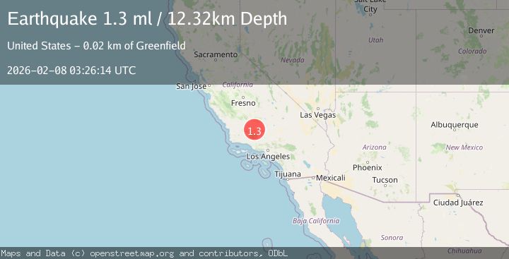
A 1.3 magnitude earthquake struck on 22 km SW of Lamont, CA, at Sun, 08 Feb 2026 03:26:14 GMT. Depth: 12.32km. Reviewed by USGS seismologists, this minor quake occurred at a magnitude type of ml.
Magnitude
1.3
ml
Source
USGS
Intensity
-
Agency Reports
1 Sources| Source | Magnitude | Depth | Time |
|---|---|---|---|
| USGSPrimary | 1.3 | 12 km | 1 hour ago |
Earthquake Details
AutomaticEvent IDusgs_ci41393720
Tsunami PotentialNo
Magnitude Typeml
Nearest Places
Comments
Join the discussion about this event.
Latest Earthquakes
2.5Mag
ISLAND OF HAWAII, HAWAII
Time6 minutes ago
Depth31.80 km
SourceHV (Automatic)
2.3Mag
Bali Sea
Time8 minutes ago
Depth23.14 km
SourceBMKG (Automatic)
1.5Mag
8 km WNW of Cobb, CA
Time18 minutes ago
Depth2.02 km
SourceUSGS (Automatic)
2.4Mag
Northern Sumatra, Indonesia
Time21 minutes ago
Depth0.00 km
SourceBMKG (Automatic)
1.1Mag
9 km SW of Idyllwild, CA
Time25 minutes ago
Depth18.30 km
SourceUSGS (Automatic)
Nearby Earthquakes
1.5Mag
18 km SSW of Lamont, CA
Time1 week ago
Depth9.92 km
SourceUSGS (Automatic)
1.5Mag
14 km SSW of Arvin, CA
Time1 day ago
Depth14.97 km
SourceUSGS (Automatic)
1.6Mag
15 km ESE of Maricopa, CA
Time1 week ago
Depth0.42 km
SourceUSGS (Automatic)
1.7Mag
20 km ENE of Arvin, CA
Time1 week ago
Depth5.64 km
SourceUSGS (Automatic)
1.9Mag
19 km NW of Tehachapi, CA
Time2 weeks ago
Depth3.26 km
SourceUSGS (Automatic)