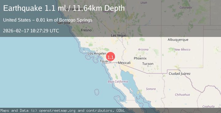
Earthquake 15 km NNE of Borrego Springs, CA
Tue, 17 Feb 2026 10:27:29 GMT
Time21 hours ago
Location
33.3680, -116.2915
Depth
11.6 KM
Event Summary
A 1.1 magnitude earthquake struck on 15 km NNE of Borrego Springs, CA, at Tue, 17 Feb 2026 10:27:29 GMT. Depth: 11.6400003433228km. Reviewed by USGS seismologists, this minor quake occurred at a magnitude type of ml.
Magnitude
1.1
ml
Source
USGS
Intensity
-
Agency Reports
1 Sources| Source | Magnitude | Depth | Time |
|---|---|---|---|
| USGSPrimary | 1.1 | 12 km | 21 hours ago |
Earthquake Details
AutomaticEvent IDusgs_ci41399224
Tsunami PotentialNo
Magnitude Typeml
Nearest Places
- Santa Rosa Mountains State Wilderness2.7 km
- Clark Well2.9 km
- Clark Lake3.7 km
- Coyote Mountain4.4 km
- Clark Valley4.4 km
Comments
Join the discussion about this event.
Latest Earthquakes
1.0Mag
Southern Alaska
Time21 hours ago
Depth46.75 km
SourceVYT (Automatic)
1.5Mag
Czech Republic
Time21 hours ago
Depth10.38 km
SourceVYT (Automatic)
4.1Mag
North of Halmahera, Indonesia
Time21 hours ago
Depth10.00 km
SourceBMKG
3.7Mag
Tarapaca, Chile
Time21 hours ago
Depth111.57 km
SourceVYT (Automatic)
1.7Mag
Java, Indonesia
Time21 hours ago
Depth17.33 km
SourceVYT (Automatic)
Nearby Earthquakes
1.1Mag
15 km NNE of Borrego Springs, CA
Time1 week ago
Depth11.25 km
SourceUSGS (Automatic)
3.0Mag
SOUTHERN CALIFORNIA
Time8 years ago
Depth14.00 km
SourceNEIR (Automatic)
2.9Mag
13 km NNE of Borrego Springs, CA
Time3 weeks ago
Depth11.34 km
SourceUSGS (Automatic)
3.0Mag
SOUTHERN CALIFORNIA
Time4 years ago
Depth9.00 km
SourceNEIC (Automatic)
1.3Mag
16 km NE of Borrego Springs, CA
Time1 week ago
Depth10.46 km
SourceUSGS (Automatic)