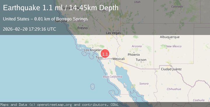
Earthquake 6 km NNW of Borrego Springs, CA
Fri, 20 Feb 2026 17:29:16 GMT
Time1 hour ago
Location
33.3110, -116.3932
Depth
14.4 KM
Event Summary
A 1.1 magnitude earthquake struck on 6 km NNW of Borrego Springs, CA, at Fri, 20 Feb 2026 17:29:16 GMT. Depth: 14.4499998092651km. Reviewed by USGS seismologists, this minor quake occurred at a magnitude type of ml.
Magnitude
1.1
ml
Source
USGS
Intensity
-
Agency Reports
1 Sources| Source | Magnitude | Depth | Time |
|---|---|---|---|
| USGSPrimary | 1.1 | 14 km | 1 hour ago |
Earthquake Details
AutomaticEvent IDusgs_ci41400472
Tsunami PotentialNo
Magnitude Typeml
Nearest Places
- Galleta Meadows1.3 km
- Henderson Canyon1.9 km
- De Anza Desert Country Club2.6 km
- El Vado Historical Marker3.5 km
- Indianhead4.0 km
Comments
Join the discussion about this event.
Latest Earthquakes
2.0Mag
Java, Indonesia
Time17 minutes ago
Depth7.57 km
SourceVYT (Automatic)
2.7Mag
Halmahera, Indonesia
Time23 minutes ago
Depth15.96 km
SourceBMKG
1.4Mag
14 km NNW of Stanton, Texas
Time25 minutes ago
Depth3.64 km
SourceUSGS (Automatic)
2.6Mag
Java, Indonesia
Time26 minutes ago
Depth12.69 km
SourceBMKG
2.2Mag
Southern Sumatra, Indonesia
Time28 minutes ago
Depth24.35 km
SourceBMKG
Nearby Earthquakes
1.0Mag
8 km N of Borrego Springs, CA
Time5 days ago
Depth14.65 km
SourceUSGS (Automatic)
3.0Mag
SOUTHERN CALIFORNIA
Time6 years ago
Depth7.00 km
SourceNEIC (Automatic)
3.0Mag
SOUTHERN CALIFORNIA
Time5 years ago
Depth10.00 km
SourceNEIC (Automatic)
1.0Mag
4 km WNW of Borrego Springs, CA
Time6 days ago
Depth5.21 km
SourceUSGS (Automatic)
0.7Mag
4 km WNW of Borrego Springs, CA
Time1 week ago
Depth4.99 km
SourceUSGS (Automatic)