Earthquake 2 km NNW of The Geysers, CA
Mon, 12 Jan 2026 13:35:37 GMT
Time12 hours ago
Location
38.7935, -122.7618
Depth
0.4 KM
Event Summary
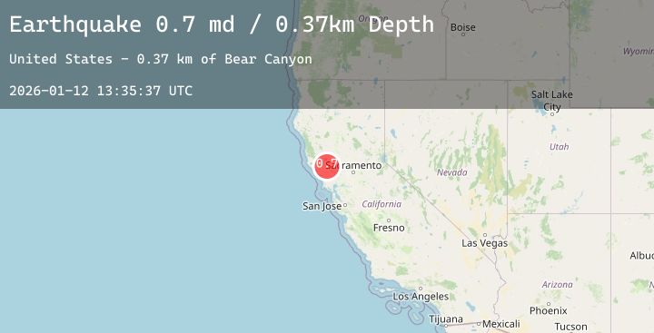
A 1.3 magnitude earthquake struck on 2 km NNW of The Geysers, CA, at Mon, 12 Jan 2026 13:35:37 GMT. Depth: 0.370000004768372km. Reviewed by USGS seismologists, this minor quake occurred at a magnitude type of md.
Magnitude
1.3
md
Source
USGS
Intensity
-
Agency Reports
6 Sources| Source | Magnitude | Depth | Time |
|---|---|---|---|
| USGSPrimary | 0.7 | 0 km | 12 hours ago |
| USGSPrimary | 0.3 | 2 km | 12 hours ago |
| USGSPrimary | 1.1 | -0 km | 12 hours ago |
| USGSPrimary | 1.0 | -0 km | 11 hours ago |
| USGSPrimary | 1.3 | 2 km | 11 hours ago |
| USGSPrimary | 1.3 | 2 km | 11 hours ago |
Earthquake Details
AutomaticEvent IDusgs_nc75294571
Tsunami PotentialNo
Magnitude Typemd
Nearest Places
- Burned Mountain1.0 km
- Smudgeo Number 1 Heliport1.2 km
- Hot Springs Creek1.9 km
- The Geysers2.1 km
- Geyser Rock2.3 km
Comments
Join the discussion about this event.
Latest Earthquakes
2.2Mag
WESTERN TEXAS
Time7 minutes ago
Depth4.70 km
SourceTX (Automatic)
2.3Mag
Sumbawa Region, Indonesia
Time7 minutes ago
Depth24.94 km
SourceBMKG (Automatic)
3.7Mag
CYPRUS REGION
Time14 minutes ago
Depth10.00 km
SourceAFAD (Automatic)
5.2Mag
Northern Molucca Sea
Time15 minutes ago
Depth30.56 km
SourceBMKG (Automatic)
3.5Mag
NEAR S. COAST OF HONSHU, JAPAN
Time21 minutes ago
Depth40.00 km
SourceJMA (Automatic)
Nearby Earthquakes
0.8Mag
9 km NW of The Geysers, CA
Time24 minutes ago
Depth2.20 km
SourceUSGS (Automatic)
1.4Mag
1 km NNW of Middletown, CA
Time1 hour ago
Depth7.23 km
SourceUSGS (Automatic)
1.0Mag
6 km NW of The Geysers, CA
Time2 hours ago
Depth2.63 km
SourceUSGS (Automatic)
0.7Mag
3 km NW of The Geysers, CA
Time3 hours ago
Depth3.53 km
SourceUSGS (Automatic)
0.5Mag
3 km N of The Geysers, CA
Time5 hours ago
Depth2.64 km
SourceUSGS (Automatic)