Earthquake 7 km NW of The Geysers, CA
Sat, 17 Jan 2026 01:42:50 GMT
Time4 hours ago
Location
38.8207, -122.8133
Depth
2.7 KM
Event Summary
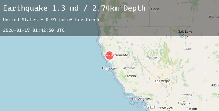
A 1.3 magnitude earthquake struck on 7 km NW of The Geysers, CA, at Sat, 17 Jan 2026 01:42:50 GMT. Depth: 2.74000000953674km. Reviewed by USGS seismologists, this minor quake occurred at a magnitude type of md.
Magnitude
1.3
md
Source
USGS
Intensity
-
Agency Reports
2 Sources| Source | Magnitude | Depth | Time |
|---|---|---|---|
| USGSPrimary | 1.3 | 3 km | 4 hours ago |
| USGSPrimary | 1.3 | 1 km | 4 hours ago |
Earthquake Details
AutomaticEvent IDusgs_nc75296771
Tsunami PotentialNo
Magnitude Typemd
Nearest Places
- Bear Canyon0.8 km
- Coldwater Canyon1.6 km
- Black Oaks2.0 km
- Geyser Canyon2.4 km
- Geysers Resort2.5 km
Comments
Join the discussion about this event.
Latest Earthquakes
2.4Mag
Sulawesi, Indonesia
Time3 hours ago
Depth2.76 km
SourceBMKG (Automatic)
1.9Mag
2 km SSW of Indios, Puerto Rico
Time3 hours ago
Depth15.91 km
SourceUSGS
2.1Mag
SPAIN
Time3 hours ago
Depth0.00 km
SourceIGN (Automatic)
2.2Mag
49 km W of Anchor Point, Alaska
Time3 hours ago
Depth89.50 km
SourceUSGS (Automatic)
1.2Mag
CENTRAL TURKEY
Time3 hours ago
Depth7.00 km
SourceAFAD (Automatic)
Nearby Earthquakes
0.7Mag
6 km WNW of Cobb, CA
Time5 hours ago
Depth1.81 km
SourceUSGS (Automatic)
0.7Mag
8 km NW of The Geysers, CA
Time6 hours ago
Depth1.55 km
SourceUSGS (Automatic)
1.5Mag
9 km WNW of The Geysers, CA
Time7 hours ago
Depth2.03 km
SourceUSGS (Automatic)
1.3Mag
10 km WNW of The Geysers, CA
Time9 hours ago
Depth2.38 km
SourceUSGS (Automatic)
1.0Mag
4 km W of Cobb, CA
Time11 hours ago
Depth1.96 km
SourceUSGS (Automatic)