Earthquake 7 km NW of The Geysers, CA
Sat, 17 Jan 2026 20:58:55 GMT
Time2 hours ago
Location
38.8240, -122.8057
Depth
2.5 KM
Event Summary
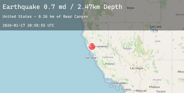
A 1.7 magnitude earthquake struck on 7 km NW of The Geysers, CA, at Sat, 17 Jan 2026 20:58:55 GMT. Depth: 2.47000002861023km. Reviewed by USGS seismologists, this minor quake occurred at a magnitude type of md.
Magnitude
1.7
md
Source
USGS
Intensity
-
Agency Reports
4 Sources| Source | Magnitude | Depth | Time |
|---|---|---|---|
| USGSPrimary | 0.7 | 2 km | 2 hours ago |
| USGSPrimary | 1.7 | 6 km | 1 hour ago |
| USGSPrimary | 0.8 | -0 km | 1 hour ago |
| USGSPrimary | 0.7 | 2 km | 1 hour ago |
Earthquake Details
AutomaticEvent IDusgs_nc75297196
Tsunami PotentialNo
Magnitude Typemd
Nearest Places
- Bear Canyon0.9 km
- Coldwater Canyon1.9 km
- Caldwell Pines2.4 km
- Black Oaks2.4 km
- Geyser Canyon2.7 km
Comments
Join the discussion about this event.
Latest Earthquakes
1.6Mag
10 km W of Houston, Alaska
Time6 minutes ago
Depth29.10 km
SourceUSGS (Automatic)
1.5Mag
7 km NE of Coso Junction, CA
Time11 minutes ago
Depth5.55 km
SourceUSGS (Automatic)
2.0Mag
PUERTO RICO REGION
Time14 minutes ago
Depth12.70 km
SourcePR (Automatic)
1.6Mag
14 km SSW of Mentone, Texas
Time21 minutes ago
Depth0.00 km
SourceUSGS (Automatic)
3.4Mag
Sunda Strait, Indonesia
Time22 minutes ago
Depth63.28 km
SourceBMKG (Automatic)
Nearby Earthquakes
0.8Mag
8 km NW of The Geysers, CA
Time34 minutes ago
Depth2.23 km
SourceUSGS (Automatic)
0.9Mag
3 km NW of The Geysers, CA
Time3 hours ago
Depth3.56 km
SourceUSGS (Automatic)
1.1Mag
8 km NW of The Geysers, CA
Time4 hours ago
Depth1.85 km
SourceUSGS (Automatic)
1.7Mag
10 km NW of The Geysers, CA
Time5 hours ago
Depth1.66 km
SourceUSGS (Automatic)
1.1Mag
8 km NW of The Geysers, CA
Time6 hours ago
Depth1.86 km
SourceUSGS (Automatic)