Earthquake 2 km ESE of Tres Pinos, CA
Fri, 06 Feb 2026 22:00:37 GMT
Time1 hour ago
Location
36.7860, -121.3020
Depth
7.9 KM
Event Summary
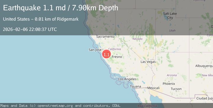
A 1.1 magnitude earthquake struck on 2 km ESE of Tres Pinos, CA, at Fri, 06 Feb 2026 22:00:37 GMT. Depth: 7.90000009536743km. Reviewed by USGS seismologists, this minor quake occurred at a magnitude type of md.
Magnitude
1.1
md
Source
USGS
Intensity
-
Agency Reports
1 Sources| Source | Magnitude | Depth | Time |
|---|---|---|---|
| USGSPrimary | 1.1 | 8 km | 1 hour ago |
Earthquake Details
AutomaticEvent IDusgs_nc75309742
Tsunami PotentialNo
Magnitude Typemd
Nearest Places
- Arroyo Hondo1.1 km
- San Benito County Golf and Country Club1.2 km
- San Benito Historical Park1.6 km
- Tres Pinos1.8 km
- Tres Pinos Post Office1.9 km
Comments
Join the discussion about this event.
Latest Earthquakes
2.6Mag
Sumba Region, Indonesia
Time15 minutes ago
Depth46.11 km
SourceBMKG (Automatic)
1.2Mag
10 km W of Pine Valley, CA
Time15 minutes ago
Depth17.65 km
SourceUSGS (Automatic)
1.6Mag
57 km NW of Toyah, Texas
Time20 minutes ago
Depth4.34 km
SourceUSGS (Automatic)
3.7Mag
Banda Sea
Time27 minutes ago
Depth61.91 km
SourceBMKG (Automatic)
2.1Mag
Southern Sumatra, Indonesia
Time28 minutes ago
Depth3.62 km
SourceBMKG (Automatic)
Nearby Earthquakes
1.2Mag
6 km NE of Ridgemark, CA
Time18 hours ago
Depth11.33 km
SourceUSGS (Automatic)
1.1Mag
3 km W of Ridgemark, CA
Time2 hours ago
Depth6.84 km
SourceUSGS (Automatic)
1.2Mag
2 km SW of Hollister, CA
Time1 week ago
Depth7.56 km
SourceUSGS (Automatic)
1.5Mag
2 km SW of Hollister, CA
Time1 week ago
Depth8.65 km
SourceUSGS (Automatic)
1.5Mag
13 km SSW of Tres Pinos, CA
Time2 weeks ago
Depth1.38 km
SourceUSGS (Automatic)