Earthquake 10 km WNW of The Geysers, CA
Sat, 14 Feb 2026 12:22:40 GMT
Time4 days ago
Location
38.8262, -122.8548
Depth
2.3 KM
Event Summary
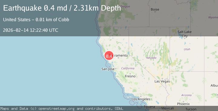
A 0.4 magnitude earthquake struck on 10 km WNW of The Geysers, CA, at Sat, 14 Feb 2026 12:22:40 GMT. Depth: 2.30999994277954km. Reviewed by USGS seismologists, this minor quake occurred at a magnitude type of md.
Magnitude
0.4
md
Source
USGS
Intensity
-
Agency Reports
1 Sources| Source | Magnitude | Depth | Time |
|---|---|---|---|
| USGSPrimary | 0.4 | 2 km | 4 days ago |
Earthquake Details
AutomaticEvent IDusgs_nc75313687
Tsunami PotentialNo
Magnitude Typemd
Nearest Places
- Buckeye Mine0.4 km
- Hummingbird Creek1.4 km
- Alder Creek1.5 km
- Truitt Creek1.5 km
- Cloverdale Mine Headquarters1.5 km
Comments
Join the discussion about this event.
Latest Earthquakes
2.9Mag
near the coast of Tarapaca, Chile
Time11 hours ago
Depth35.28 km
SourceVYT (Automatic)
2.4Mag
Java, Indonesia
Time12 hours ago
Depth39.57 km
SourceBMKG
2.3Mag
56 km SSE of Perryville, Alaska
Time12 hours ago
Depth34.70 km
SourceUSGS (Automatic)
2.1Mag
Antofagasta, Chile
Time12 hours ago
Depth20.26 km
SourceVYT (Automatic)
1.5Mag
48 km WNW of Tatitlek, Alaska
Time12 hours ago
Depth5.00 km
SourceUSGS (Automatic)
Nearby Earthquakes
1.5Mag
10 km WNW of The Geysers, CA
Time3 weeks ago
Depth2.37 km
SourceUSGS (Automatic)
0.8Mag
10 km WNW of The Geysers, CA
Time3 weeks ago
Depth2.37 km
SourceUSGS (Automatic)
0.8Mag
10 km WNW of The Geysers, CA
Time3 weeks ago
Depth1.49 km
SourceUSGS (Automatic)
1.5Mag
10 km NW of The Geysers, CA
Time2 weeks ago
Depth2.45 km
SourceUSGS (Automatic)
1.2Mag
10 km WNW of The Geysers, CA
Time3 weeks ago
Depth2.21 km
SourceUSGS (Automatic)