Earthquake 31 km NW of Toyah, Texas
Sat, 17 Jan 2026 11:46:40 GMT
Time1 hour ago
Location
31.5260, -104.0220
Depth
4.5 KM
Event Summary
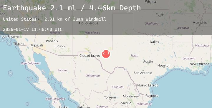
A 2.1 magnitude earthquake struck on 31 km NW of Toyah, Texas, at Sat, 17 Jan 2026 11:46:40 GMT. Depth: 4.4551km. Reviewed by USGS seismologists, this minor quake occurred at a magnitude type of ml.
Magnitude
2.1
ml
Source
USGS
Intensity
-
Agency Reports
2 Sources| Source | Magnitude | Depth | Time |
|---|---|---|---|
| USGSPrimary | 2.1 | 4 km | 1 hour ago |
| TX | 2.1 | 5 km | 1 hour ago |
Earthquake Details
AutomaticEvent IDusgs_tx2026behaxl
Tsunami PotentialNo
Magnitude Typeml
Nearest Places
- Juan Windmill2.0 km
- Dry Lake3.6 km
- Dutch Draw5.2 km
- Lynn Tank6.4 km
- Oil Well Windmill8.0 km
Comments
Join the discussion about this event.
Latest Earthquakes
3.1Mag
Off West Coast of Northern Sumatra
Time1 hour ago
Depth40.28 km
SourceBMKG (Automatic)
2.2Mag
Flores Region, Indonesia
Time2 hours ago
Depth11.17 km
SourceBMKG (Automatic)
3.6Mag
West Papua Region, Indonesia
Time2 hours ago
Depth10.00 km
SourceBMKG (Automatic)
1.6Mag
20 km W of Winters, CA
Time2 hours ago
Depth4.63 km
SourceUSGS (Automatic)
1.5Mag
1 km NE of Paramount, CA
Time2 hours ago
Depth8.88 km
SourceUSGS (Automatic)
Nearby Earthquakes
1.8Mag
58 km NW of Toyah, Texas
Time2 hours ago
Depth4.17 km
SourceUSGS (Automatic)
1.7Mag
61 km S of Whites City, New Mexico
Time3 hours ago
Depth4.88 km
SourceUSGS (Automatic)
2.4Mag
WESTERN TEXAS
Time6 hours ago
Depth6.90 km
SourceTX (Automatic)
2.3Mag
WESTERN TEXAS
Time8 hours ago
Depth4.60 km
SourceTX (Automatic)
1.9Mag
13 km NNE of Toyah, Texas
Time11 hours ago
Depth6.58 km
SourceUSGS (Automatic)