Earthquake 58 km NW of Toyah, Texas
Sat, 17 Jan 2026 10:40:27 GMT
Time2 hours ago
Location
31.6360, -104.2770
Depth
4.2 KM
Event Summary
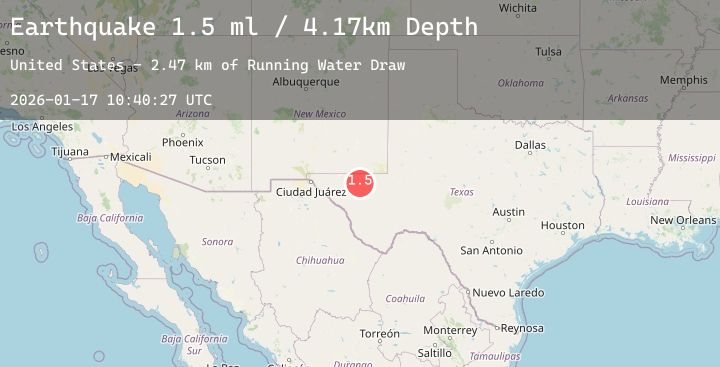
A 1.8 magnitude earthquake struck on 58 km NW of Toyah, Texas, at Sat, 17 Jan 2026 10:40:27 GMT. Depth: 4.1702km. Reviewed by USGS seismologists, this minor quake occurred at a magnitude type of ml.
Magnitude
1.8
ml
Source
USGS
Intensity
-
Agency Reports
2 Sources| Source | Magnitude | Depth | Time |
|---|---|---|---|
| USGSPrimary | 1.5 | 4 km | 2 hours ago |
| USGSPrimary | 1.8 | 4 km | 1 hour ago |
Earthquake Details
AutomaticEvent IDusgs_tx2026beevsz
Tsunami PotentialNo
Magnitude Typeml
Nearest Places
- Running Water Draw3.0 km
- West Windmill4.3 km
- Rustler Spring4.8 km
- Salt Grass Windmill5.4 km
- Old Grapevine Well6.6 km
Comments
Join the discussion about this event.
Latest Earthquakes
3.4Mag
Southern Molucca Sea
Time6 minutes ago
Depth10.00 km
SourceBMKG (Automatic)
3.4Mag
NORTH ISLAND OF NEW ZEALAND
Time13 minutes ago
Depth150.50 km
SourceGNS (Automatic)
2.3Mag
Flores Region, Indonesia
Time13 minutes ago
Depth8.82 km
SourceBMKG (Automatic)
2.4Mag
Northern Sumatra, Indonesia
Time18 minutes ago
Depth3.00 km
SourceBMKG (Automatic)
4.1Mag
SOUTHWESTERN RYUKYU ISL., JAPAN
Time23 minutes ago
Depth20.00 km
SourceJMA (Automatic)
Nearby Earthquakes
3.3Mag
31 km NW of Toyah, Texas
Time1 hour ago
Depth4.46 km
SourceUSGS (Automatic)
1.7Mag
61 km S of Whites City, New Mexico
Time3 hours ago
Depth4.88 km
SourceUSGS (Automatic)
2.4Mag
WESTERN TEXAS
Time6 hours ago
Depth6.90 km
SourceTX (Automatic)
2.3Mag
WESTERN TEXAS
Time7 hours ago
Depth4.60 km
SourceTX (Automatic)
1.9Mag
13 km NNE of Toyah, Texas
Time11 hours ago
Depth6.58 km
SourceUSGS (Automatic)