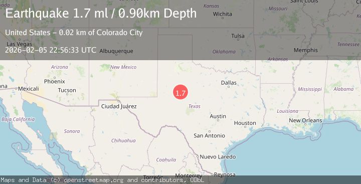
Earthquake 22 km S of Westbrook, Texas
Thu, 05 Feb 2026 22:19:56 GMT
Time1 hour ago
Location
32.1570, -101.0520
Depth
4.0 KM
Event Summary
A 1.7 magnitude earthquake struck on 22 km S of Westbrook, Texas, at Thu, 05 Feb 2026 22:19:56 GMT. Depth: 4.005km. Reviewed by USGS seismologists, this minor quake occurred at a magnitude type of ml.
Magnitude
1.7
ml
Source
USGS
Intensity
-
Agency Reports
1 Sources| Source | Magnitude | Depth | Time |
|---|---|---|---|
| USGSPrimary | 1.7 | 1 km | 48 minutes ago |
Earthquake Details
AutomaticEvent IDusgs_tx2026cnysqv
Tsunami PotentialNo
Magnitude Typeml
Nearest Places
- Forest Creek0.9 km
- Mustang Creek1.1 km
- White Dam1.6 km
- Tom Neff Lake Dam2.0 km
- Tom Neff Lake2.1 km
Comments
Join the discussion about this event.
Latest Earthquakes
3.1Mag
ANDREANOF ISLANDS, ALEUTIAN IS.
Time12 minutes ago
Depth43.30 km
SourceAK (Automatic)
2.8Mag
TARAPACA, CHILE
Time17 minutes ago
Depth56.60 km
SourceCSN (Automatic)
1.6Mag
12 km SSW of Susitna, Alaska
Time21 minutes ago
Depth47.90 km
SourceUSGS
1.4Mag
WESTERN TURKEY
Time23 minutes ago
Depth6.50 km
SourceEMSC (Automatic)
1.8Mag
WESTERN TURKEY
Time31 minutes ago
Depth7.10 km
SourceEMSC (Automatic)
Nearby Earthquakes
1.8Mag
26 km S of Westbrook, Texas
Time1 week ago
Depth2.88 km
SourceUSGS (Automatic)
1.8Mag
25 km S of Westbrook, Texas
Time1 week ago
Depth2.05 km
SourceUSGS (Automatic)
1.7Mag
27 km S of Westbrook, Texas
Time2 weeks ago
Depth4.23 km
SourceUSGS (Automatic)
1.6Mag
19 km S of Westbrook, Texas
Time19 hours ago
Depth2.17 km
SourceUSGS (Automatic)
2.6Mag
WESTERN TEXAS
Time17 hours ago
Depth1.60 km
SourceTX (Automatic)