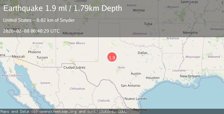
Earthquake 24 km SW of Snyder, Texas
Sun, 08 Feb 2026 06:40:29 GMT
Time1 hour ago
Location
32.5660, -101.1040
Depth
1.8 KM
Event Summary
A 1.9 magnitude earthquake struck on 24 km SW of Snyder, Texas, at Sun, 08 Feb 2026 06:40:29 GMT. Depth: 1.7925km. Reviewed by USGS seismologists, this minor quake occurred at a magnitude type of ml.
Magnitude
1.9
ml
Source
USGS
Intensity
-
Agency Reports
1 Sources| Source | Magnitude | Depth | Time |
|---|---|---|---|
| USGSPrimary | 1.9 | 2 km | 1 hour ago |
Earthquake Details
AutomaticEvent IDusgs_tx2026csgwog
Tsunami PotentialNo
Magnitude Typeml
Nearest Places
- Bull Creek2.0 km
- Lake J B Thomas Dam3.5 km
- Bluff Creek4.5 km
- Bluff Creek Cemetery5.2 km
- Dunn Lake5.2 km
Comments
Join the discussion about this event.
Latest Earthquakes
0.5Mag
5 km W of Palomar Observatory, CA
Time5 minutes ago
Depth13.86 km
SourceUSGS (Automatic)
2.6Mag
Sumbawa Region, Indonesia
Time6 minutes ago
Depth10.00 km
SourceBMKG (Automatic)
2.6Mag
Sumbawa Region, Indonesia
Time7 minutes ago
Depth66.96 km
SourceBMKG (Automatic)
2.6Mag
Sulawesi, Indonesia
Time12 minutes ago
Depth30.97 km
SourceBMKG (Automatic)
2.0Mag
ISLAND OF HAWAII, HAWAII
Time20 minutes ago
Depth4.90 km
SourceHV (Automatic)
Nearby Earthquakes
1.3Mag
24 km SW of Snyder, Texas
Time1 week ago
Depth5.74 km
SourceUSGS (Automatic)
1.2Mag
24 km SW of Snyder, Texas
Time1 week ago
Depth3.17 km
SourceUSGS (Automatic)
4.3Mag
WESTERN TEXAS
Time1 week ago
Depth6.50 km
SourceTX (Automatic)
1.3Mag
24 km NNW of Westbrook, Texas
Time1 week ago
Depth3.71 km
SourceUSGS (Automatic)
1.7Mag
23 km SW of Snyder, Texas
Time1 week ago
Depth2.60 km
SourceUSGS (Automatic)