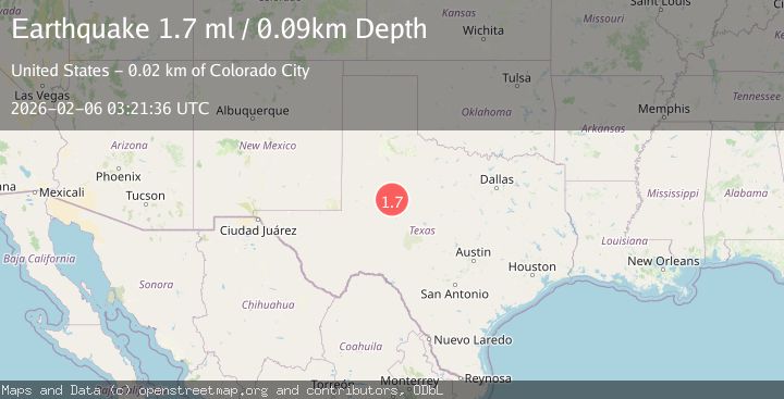
Earthquake 3 km NNW of Westbrook, Texas
Fri, 06 Feb 2026 03:21:36 GMT
Time1 hour ago
Location
32.3830, -101.0250
Depth
0.1 KM
Event Summary
A 1.7 magnitude earthquake struck on 3 km NNW of Westbrook, Texas, at Fri, 06 Feb 2026 03:21:36 GMT. Depth: 0.089km. Reviewed by USGS seismologists, this minor quake occurred at a magnitude type of ml.
Magnitude
1.7
ml
Source
USGS
Intensity
-
Agency Reports
1 Sources| Source | Magnitude | Depth | Time |
|---|---|---|---|
| USGSPrimary | 1.7 | 0 km | 1 hour ago |
Earthquake Details
AutomaticEvent IDusgs_tx2026coivkl
Tsunami PotentialNo
Magnitude Typeml
Nearest Places
- Hasting Creek1.6 km
- Butler Camp2.4 km
- Butler Lake Dam2.7 km
- Butler Lake2.7 km
- Westbrook Volunteer Fire Department2.8 km
Comments
Join the discussion about this event.
Latest Earthquakes
3.5Mag
Southern Sumatra, Indonesia
Time4 minutes ago
Depth67.02 km
SourceBMKG (Automatic)
2.8Mag
Bali Region, Indonesia
Time6 minutes ago
Depth94.28 km
SourceBMKG (Automatic)
2.4Mag
FRANCE
Time18 minutes ago
Depth5.00 km
SourceReNaSS (Automatic)
3.3Mag
SOUTH OF KERMADEC ISLANDS
Time19 minutes ago
Depth100.00 km
SourceGNS (Automatic)
1.7Mag
10 km E of Mina, Nevada
Time20 minutes ago
Depth0.00 km
SourceUSGS (Automatic)
Nearby Earthquakes
2.6Mag
WESTERN TEXAS
Time22 hours ago
Depth1.60 km
SourceTX (Automatic)
0.9Mag
23 km SW of Snyder, Texas
Time1 week ago
Depth3.41 km
SourceUSGS (Automatic)
1.3Mag
23 km SW of Snyder, Texas
Time1 week ago
Depth2.69 km
SourceUSGS (Automatic)
1.8Mag
23 km SW of Snyder, Texas
Time1 week ago
Depth2.05 km
SourceUSGS (Automatic)
1.7Mag
23 km SW of Snyder, Texas
Time1 week ago
Depth2.60 km
SourceUSGS (Automatic)