Earthquake north of Halmahera, Indonesia
Sun, 15 Feb 2026 20:48:17 GMT
Time2 days ago
Location
4.3385, 128.3198
Depth
10.0 KM
Event Summary
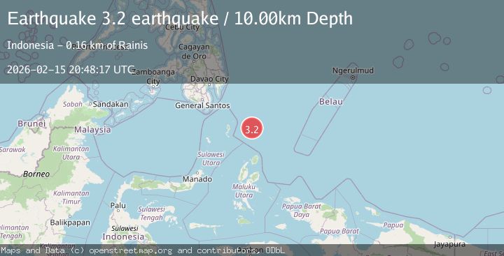
A 3.2 magnitude earthquake struck on north of Halmahera, Indonesia, at Sun, 15 Feb 2026 20:48:17 GMT. Depth: 10km. Reviewed by VYT seismologists, this minor quake occurred at a magnitude type of earthquake.
Magnitude
3.2
earthquake
Source
VYT
Intensity
-
Agency Reports
1 Sources| Source | Magnitude | Depth | Time |
|---|---|---|---|
| VYTPrimary | 3.2 | 10 km | 2 days ago |
Earthquake Details
AutomaticEvent IDvyt_1t1w5l0rk315h
Tsunami PotentialNo
Magnitude Typeearthquake
Nearest Places
- Snellius Ridge51.7 km
- Talaud Trough107.0 km
- Pulau Kakorotan132.6 km
- Desa Kakorotan132.6 km
- Pulau Intata133.1 km
Comments
Join the discussion about this event.
Latest Earthquakes
2.6Mag
Central Alaska
Time10 hours ago
Depth0.00 km
SourceVYT (Automatic)
3.9Mag
Ceram Sea
Time10 hours ago
Depth10.40 km
SourceBMKG
2.2Mag
Central Alaska
Time10 hours ago
Depth35.40 km
SourceVYT (Automatic)
1.1Mag
3 km W of Cobb, CA
Time10 hours ago
Depth1.93 km
SourceUSGS (Automatic)
1.6Mag
14 km W of Johannesburg, CA
Time10 hours ago
Depth2.16 km
SourceUSGS (Automatic)
Nearby Earthquakes
3.9Mag
NORTH OF HALMAHERA, INDONESIA
Time4 days ago
Depth25.00 km
SourceBMKG (Automatic)
3.9Mag
North of Halmahera, Indonesia
Time4 days ago
Depth10.00 km
SourceBMKG
4.7Mag
north of Halmahera, Indonesia
Time2 days ago
Depth10.00 km
SourceVYT (Automatic)
5.7Mag
north of Halmahera, Indonesia
Time4 days ago
Depth10.00 km
SourceVYT (Automatic)
4.5Mag
North of Halmahera, Indonesia
Time4 days ago
Depth10.00 km
SourceBMKG