Earthquake North of Halmahera, Indonesia
Sat, 14 Feb 2026 00:35:19 GMT
Time4 days ago
Location
4.2725, 128.3239
Depth
10.0 KM
Event Summary
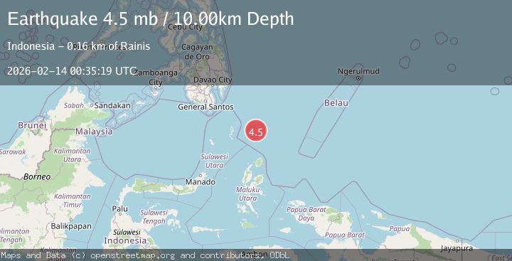
A 4.5 magnitude earthquake struck on North of Halmahera, Indonesia, at Sat, 14 Feb 2026 00:35:19 GMT. Depth: 10km. Reviewed by BMKG seismologists, this light quake occurred at a magnitude type of M.
Magnitude
4.5
M
Source
BMKG
Intensity
-
Agency Reports
1 Sources| Source | Magnitude | Depth | Time |
|---|---|---|---|
| BMKGPrimary | 4.5 | 10 km | 4 days ago |
Earthquake Details
ManualEvent IDbmg2026dclh
Tsunami PotentialNo
Magnitude TypeM
Nearest Places
- Snellius Ridge47.0 km
- Talaud Trough105.1 km
- Pulau Kakorotan135.0 km
- Desa Kakorotan135.0 km
- Pulau Intata135.6 km
Comments
Join the discussion about this event.
Latest Earthquakes
2.6Mag
Java, Indonesia
Time22 hours ago
Depth144.90 km
SourceVYT (Automatic)
3.9Mag
Sunda Strait, Indonesia
Time22 hours ago
Depth97.11 km
SourceBMKG
1.1Mag
6 km N of Running Springs, CA
Time22 hours ago
Depth10.46 km
SourceUSGS (Automatic)
1.7Mag
46 km SSE of Whites City, New Mexico
Time22 hours ago
Depth4.66 km
SourceUSGS (Automatic)
2.2Mag
Halmahera, Indonesia
Time22 hours ago
Depth13.54 km
SourceBMKG
Nearby Earthquakes
3.9Mag
North of Halmahera, Indonesia
Time4 days ago
Depth91.68 km
SourceBMKG
4.7Mag
north of Halmahera, Indonesia
Time2 days ago
Depth10.00 km
SourceVYT (Automatic)
4.6Mag
North of Halmahera, Indonesia
Time5 days ago
Depth21.15 km
SourceBMKG
3.2Mag
north of Halmahera, Indonesia
Time2 days ago
Depth10.00 km
SourceVYT (Automatic)
4.4Mag
north of Halmahera, Indonesia
Time2 days ago
Depth10.00 km
SourceVYT (Automatic)