Earthquake SOUTHERN ALASKA
Fri, 10 Jan 2020 01:55:14 GMT
Time6 years ago
Location
61.4500, -146.4700
Depth
35.0 KM
Event Summary
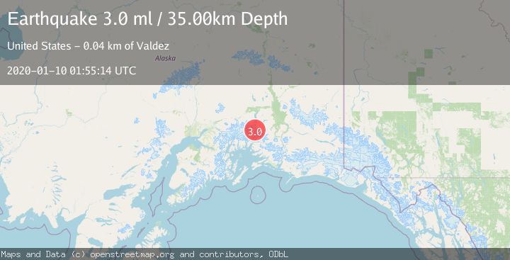
A 3.0 magnitude earthquake struck on SOUTHERN ALASKA, at Fri, 10 Jan 2020 01:55:14 GMT. Depth: 35km. Reviewed by NEIC seismologists, this minor quake occurred at a magnitude type of ml.
Magnitude
3.0
ml
Source
NEIC
Intensity
-
Agency Reports
1 Sources| Source | Magnitude | Depth | Time |
|---|---|---|---|
| NEICPrimary | 3.0 | 35 km | 6 years ago |
Earthquake Details
AutomaticEvent IDemsc_NEIC_20200110_0000011
Tsunami PotentialNo
Magnitude Typeml
Nearest Places
- Tazlina Glacier8.5 km
- Mount Cashman9.3 km
- Brontosaurus Mountain9.6 km
- Stephens Glacier10.2 km
- Mount Shouplina12.4 km
Comments
Join the discussion about this event.
Latest Earthquakes
1.9Mag
western Texas
Time17 hours ago
Depth5.00 km
SourceVYT (Automatic)
2.2Mag
Flores Region, Indonesia
Time17 hours ago
Depth28.78 km
SourceBMKG
1.8Mag
Antofagasta, Chile
Time17 hours ago
Depth32.10 km
SourceVYT (Automatic)
1.4Mag
FRANCE
Time17 hours ago
Depth2.40 km
SourceETHZ (Automatic)
2.4Mag
Minahassa Peninsula, Sulawesi
Time17 hours ago
Depth7.56 km
SourceBMKG
Nearby Earthquakes
3.0Mag
SOUTHERN ALASKA
Time4 years ago
Depth28.00 km
SourceNEIC (Automatic)
1.9Mag
37 km NNW of Valdez, Alaska
Time3 weeks ago
Depth36.10 km
SourceUSGS (Automatic)
3.0Mag
SOUTHERN ALASKA
Time8 months ago
Depth34.50 km
SourceNEIC (Automatic)
3.0Mag
SOUTHERN ALASKA
Time2 years ago
Depth32.00 km
SourceNEIC (Automatic)
1.7Mag
Southern Alaska
Time1 week ago
Depth19.17 km
SourceVYT (Automatic)