Earthquake Southeastern Alaska
Mon, 16 Feb 2026 11:11:31 GMT
Time2 days ago
Location
60.2281, -141.3512
Depth
12.7 KM
Event Summary
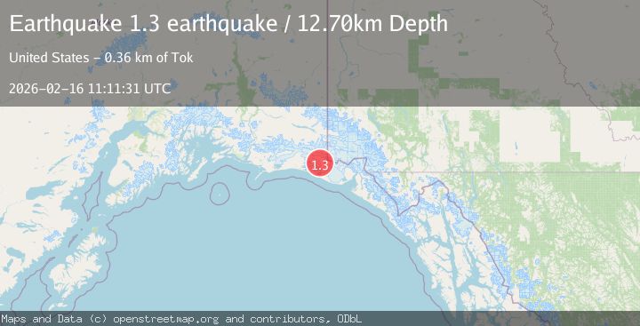
A 1.3 magnitude earthquake struck on Southeastern Alaska, at Mon, 16 Feb 2026 11:11:31 GMT. Depth: 12.6953125km. Reviewed by VYT seismologists, this minor quake occurred at a magnitude type of earthquake.
Magnitude
1.3
earthquake
Source
VYT
Intensity
-
Agency Reports
1 Sources| Source | Magnitude | Depth | Time |
|---|---|---|---|
| VYTPrimary | 1.3 | 13 km | 2 days ago |
Earthquake Details
AutomaticEvent IDvyt_2445gujoo2vf5
Tsunami PotentialNo
Magnitude Typeearthquake
Nearest Places
- Coal Glacier6.4 km
- Guyot Hills7.4 km
- Daisy Glacier8.7 km
- Karr Hills9.8 km
- Tyndall Glacier12.0 km
Comments
Join the discussion about this event.
Latest Earthquakes
2.3Mag
Minahassa Peninsula, Sulawesi
Time8 hours ago
Depth4.61 km
SourceBMKG
2.1Mag
Alaska Peninsula
Time8 hours ago
Depth104.25 km
SourceVYT (Automatic)
3.0Mag
West Papua Region, Indonesia
Time8 hours ago
Depth10.00 km
SourceBMKG
1.4Mag
Czech Republic
Time8 hours ago
Depth19.17 km
SourceVYT (Automatic)
2.3Mag
northern Alaska
Time8 hours ago
Depth0.00 km
SourceVYT (Automatic)
Nearby Earthquakes
5.0Mag
SOUTHERN ALASKA
Time3 years ago
Depth20.00 km
SourceEMSC (Automatic)
2.9Mag
120 km NW of Yakutat, Alaska
Time3 weeks ago
Depth5.00 km
SourceUSGS (Automatic)
3.0Mag
110 km NW of Yakutat, Alaska
Time3 weeks ago
Depth16.90 km
SourceUSGS (Automatic)
3.0Mag
SOUTHERN ALASKA
Time2 years ago
Depth10.00 km
SourceNEIC (Automatic)
1.1Mag
Southeastern Alaska
Time2 days ago
Depth0.00 km
SourceVYT (Automatic)