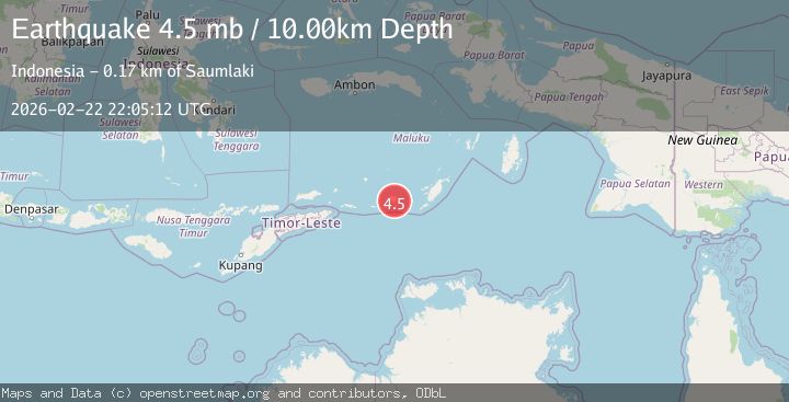
Earthquake Kepulauan Tanimbar, Indonesia
Sun, 22 Feb 2026 22:05:15 GMT
Time1 hour ago
Location
-7.8547, 130.1773
Depth
127.2 KM
Event Summary
A 3.7 magnitude earthquake struck on Kepulauan Tanimbar, Indonesia, at Sun, 22 Feb 2026 22:05:15 GMT. Depth: 127.197265625km. Reviewed by VYT seismologists, this minor quake occurred at a magnitude type of earthquake.
Magnitude
3.7
earthquake
Source
VYT
Intensity
-
Agency Reports
1 Sources| Source | Magnitude | Depth | Time |
|---|---|---|---|
| VYTPrimary | 3.7 | 127 km | 1 hour ago |
Earthquake Details
AutomaticEvent IDvyt_32lmg4jo1tc28
Tsunami PotentialNo
Magnitude Typeearthquake
Nearest Places
- 13.9 km
- 14.2 km
- 14.7 km
- 15.4 km
- 15.6 km
Comments
Join the discussion about this event.
Latest Earthquakes
1.2Mag
Southern Alaska
Time1 hour ago
Depth16.24 km
SourceVYT (Automatic)
2.4Mag
Queensland, Australia
Time1 hour ago
Depth740.23 km
SourceVYT (Automatic)
1.3Mag
WESTERN TURKEY
Time1 hour ago
Depth4.00 km
SourceAFAD (Automatic)
2.5Mag
Antofagasta, Chile
Time1 hour ago
Depth13.06 km
SourceVYT (Automatic)
1.4Mag
Southeastern Alaska
Time1 hour ago
Depth0.00 km
SourceVYT (Automatic)
Nearby Earthquakes
3.5Mag
Tanimbar Islands Region, Indonesia
Time2 weeks ago
Depth105.26 km
SourceBMKG (Automatic)
5.9Mag
Tanimbar Islands Region, Indonesia
Time2 weeks ago
Depth100.00 km
SourceBMKG (Automatic)
3.1Mag
Kepulauan Tanimbar, Indonesia
Time1 week ago
Depth141.97 km
SourceVYT (Automatic)
3.5Mag
Tanimbar Islands Region, Indonesia
Time1 week ago
Depth84.60 km
SourceBMKG
5.1Mag
KEP. TANIMBAR REGION, INDONESIA
Time3 years ago
Depth60.00 km
SourceEMSC (Automatic)