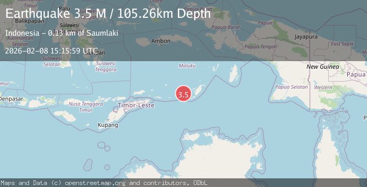
Earthquake Tanimbar Islands Region, Indonesia
Sun, 08 Feb 2026 15:15:59 GMT
Time1 day ago
Location
-7.8531, 130.1631
Depth
105.3 KM
Event Summary
A 3.5 magnitude earthquake struck on Tanimbar Islands Region, Indonesia, at Sun, 08 Feb 2026 15:15:59 GMT. Depth: 105.259361km. Reviewed by BMKG seismologists, this minor quake occurred at a magnitude type of M.
Magnitude
3.5
M
Source
BMKG
Intensity
-
Agency Reports
1 Sources| Source | Magnitude | Depth | Time |
|---|---|---|---|
| BMKGPrimary | 3.5 | 105 km | 1 day ago |
Earthquake Details
AutomaticEvent IDbmg2026cspi
Tsunami PotentialNo
Magnitude TypeM
Nearest Places
- Desa Nurnyaman12.6 km
- Nurnyaman12.9 km
- Desa Wiratan13.5 km
- Pulau Daweloor14.2 km
- Kecamatan Dawelor Dawera14.4 km
Comments
Join the discussion about this event.
Latest Earthquakes
0.7Mag
6 km NW of The Geysers, CA
Time5 minutes ago
Depth3.21 km
SourceUSGS (Automatic)
2.7Mag
Timor Region
Time10 minutes ago
Depth95.97 km
SourceBMKG (Automatic)
3.0Mag
COOK STRAIT, NEW ZEALAND
Time25 minutes ago
Depth38.30 km
SourceGNS (Automatic)
1.2Mag
20 km NNW of Amboy, Washington
Time27 minutes ago
Depth12.18 km
SourceUSGS
3.1Mag
VIRGIN ISLANDS REGION
Time30 minutes ago
Depth9.90 km
SourcePR (Automatic)
Nearby Earthquakes
5.9Mag
Tanimbar Islands Region, Indonesia
Time2 days ago
Depth100.00 km
SourceBMKG (Automatic)
3.5Mag
Tanimbar Islands Region, Indonesia
Time2 hours ago
Depth126.00 km
SourceBMKG (Automatic)
4.2Mag
Tanimbar Islands Region, Indonesia
Time2 days ago
Depth137.60 km
SourceBMKG (Automatic)
3.6Mag
Tanimbar Islands Region, Indonesia
Time1 week ago
Depth224.21 km
SourceBMKG (Automatic)
5.0Mag
Tanimbar Islands Region, Indonesia
Time1 week ago
Depth28.16 km
SourceBMKG (Automatic)