Earthquake Southern Alaska
Sun, 15 Feb 2026 14:28:36 GMT
Time3 days ago
Location
61.1735, -147.3088
Depth
7.6 KM
Event Summary
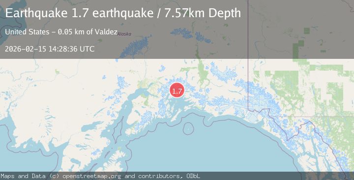
A 1.7 magnitude earthquake struck on Southern Alaska, at Sun, 15 Feb 2026 14:28:36 GMT. Depth: 7.568359375km. Reviewed by VYT seismologists, this minor quake occurred at a magnitude type of earthquake.
Magnitude
1.7
earthquake
Source
VYT
Intensity
-
Agency Reports
1 Sources| Source | Magnitude | Depth | Time |
|---|---|---|---|
| VYTPrimary | 1.7 | 8 km | 3 days ago |
Earthquake Details
AutomaticEvent IDvyt_3hkedgz1y2bqz
Tsunami PotentialNo
Magnitude Typeearthquake
Nearest Places
- Pedro Glacier4.7 km
- Mount Grosvenor6.4 km
- Meares Glacier7.2 km
- Brilliant Glacier8.6 km
- Columbia Peak9.7 km
Comments
Join the discussion about this event.
Latest Earthquakes
2.3Mag
offshore Atacama, Chile
Time13 hours ago
Depth0.24 km
SourceVYT (Automatic)
3.1Mag
Sulawesi, Indonesia
Time13 hours ago
Depth0.00 km
SourceVYT (Automatic)
2.4Mag
western Texas
Time13 hours ago
Depth4.15 km
SourceVYT (Automatic)
1.3Mag
Alaska Peninsula
Time13 hours ago
Depth0.00 km
SourceVYT (Automatic)
2.4Mag
Antofagasta, Chile
Time13 hours ago
Depth141.60 km
SourceVYT (Automatic)
Nearby Earthquakes
1.8Mag
44 km NW of Tatitlek, Alaska
Time2 weeks ago
Depth17.80 km
SourceUSGS (Automatic)
1.7Mag
44 km NW of Tatitlek, Alaska
Time2 weeks ago
Depth5.00 km
SourceUSGS (Automatic)
1.8Mag
44 km NW of Tatitlek, Alaska
Time2 weeks ago
Depth2.60 km
SourceUSGS (Automatic)
1.8Mag
48 km NW of Tatitlek, Alaska
Time2 weeks ago
Depth17.40 km
SourceUSGS (Automatic)
3.5Mag
45 km NW of Tatitlek, Alaska
Time3 weeks ago
Depth13.60 km
SourceUSGS (Automatic)