Earthquake Southeastern Alaska
Thu, 12 Feb 2026 04:05:33 GMT
Time6 days ago
Location
60.3036, -141.1889
Depth
23.6 KM
Event Summary
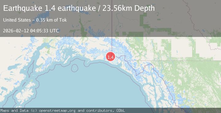
A 1.4 magnitude earthquake struck on Southeastern Alaska, at Thu, 12 Feb 2026 04:05:33 GMT. Depth: 23.5595703125km. Reviewed by VYT seismologists, this minor quake occurred at a magnitude type of earthquake.
Magnitude
1.4
earthquake
Source
VYT
Intensity
-
Agency Reports
1 Sources| Source | Magnitude | Depth | Time |
|---|---|---|---|
| VYTPrimary | 1.4 | 24 km | 6 days ago |
Earthquake Details
AutomaticEvent IDvyt_i93cun14af1h
Tsunami PotentialNo
Magnitude Typeearthquake
Nearest Places
- Crater Basin3.0 km
- Mount Huxley3.2 km
- The Hump6.2 km
- Boundary Peak 18710.6 km
- Coal Glacier10.7 km
Comments
Join the discussion about this event.
Latest Earthquakes
2.0Mag
Poland
Time5 hours ago
Depth0.49 km
SourceVYT (Automatic)
1.9Mag
Antofagasta, Chile
Time5 hours ago
Depth9.40 km
SourceVYT (Automatic)
1.3Mag
8 km NW of The Geysers, CA
Time5 hours ago
Depth2.00 km
SourceUSGS (Automatic)
1.2Mag
63 km WNW of Toyah, Texas
Time5 hours ago
Depth0.08 km
SourceUSGS (Automatic)
1.4Mag
12 km SSW of Salton City, CA
Time5 hours ago
Depth5.74 km
SourceUSGS (Automatic)
Nearby Earthquakes
3.0Mag
SOUTHERN ALASKA
Time2 years ago
Depth2.50 km
SourceAK (Automatic)
1.1Mag
Southeastern Alaska
Time2 days ago
Depth0.00 km
SourceVYT (Automatic)
2.0Mag
Southeastern Alaska
Time1 day ago
Depth19.90 km
SourceVYT (Automatic)
2.9Mag
120 km NW of Yakutat, Alaska
Time3 weeks ago
Depth5.00 km
SourceUSGS (Automatic)
2.5Mag
127 km NW of Yakutat, Alaska
Time3 weeks ago
Depth19.90 km
SourceUSGS (Automatic)