Earthquake Southeastern Alaska
Fri, 13 Feb 2026 00:15:48 GMT
Time5 days ago
Location
60.4322, -140.5734
Depth
7.1 KM
Event Summary
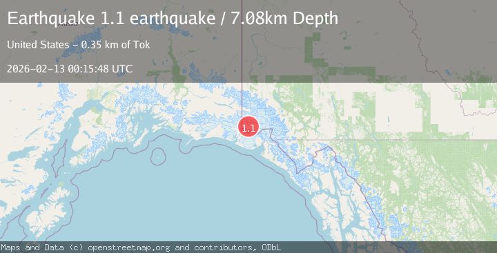
A 1.1 magnitude earthquake struck on Southeastern Alaska, at Fri, 13 Feb 2026 00:15:48 GMT. Depth: 7.080078125km. Reviewed by VYT seismologists, this minor quake occurred at a magnitude type of earthquake.
Magnitude
1.1
earthquake
Source
VYT
Intensity
-
Agency Reports
1 Sources| Source | Magnitude | Depth | Time |
|---|---|---|---|
| VYTPrimary | 1.1 | 7 km | 5 days ago |
Earthquake Details
AutomaticEvent IDvyt_kv2unvsgmpth
Tsunami PotentialNo
Magnitude Typeearthquake
Nearest Places
- Mount Bering11.3 km
- Mount Baird12.2 km
- Mount Malaspina13.1 km
- Mount Jeannette13.9 km
- Mount Augusta15.4 km
Comments
Join the discussion about this event.
Latest Earthquakes
2.9Mag
Southern Molucca Sea
Time3 hours ago
Depth170.58 km
SourceBMKG
3.2Mag
northern Colombia
Time3 hours ago
Depth140.50 km
SourceVYT (Automatic)
4.4Mag
Tarapaca, Chile
Time3 hours ago
Depth47.00 km
SourceVYT (Automatic)
1.3Mag
19 km NNW of Borrego Springs, CA
Time3 hours ago
Depth9.65 km
SourceUSGS (Automatic)
2.0Mag
Sweden
Time3 hours ago
Depth10.00 km
SourceVYT (Automatic)
Nearby Earthquakes
1.7Mag
Southeastern Alaska
Time6 days ago
Depth0.00 km
SourceVYT (Automatic)
1.3Mag
Southeastern Alaska
Time2 days ago
Depth14.40 km
SourceVYT (Automatic)
5.2Mag
SOUTHERN YUKON TERRITORY, CANADA
Time4 years ago
Depth30.00 km
SourceEMSC (Automatic)
2.7Mag
SOUTHERN YUKON TERRITORY, CANADA
Time2 months ago
Depth5.00 km
SourceNEIC (Automatic)
1.7Mag
Southeastern Alaska
Time4 days ago
Depth0.00 km
SourceVYT (Automatic)