Earthquake Southeastern Alaska
Mon, 16 Feb 2026 11:27:04 GMT
Time2 days ago
Location
60.4738, -140.3746
Depth
14.4 KM
Event Summary
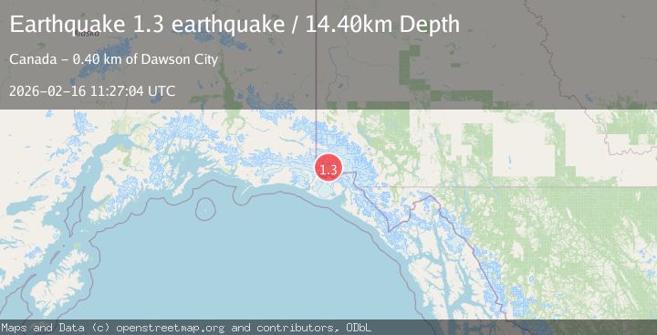
A 1.3 magnitude earthquake struck on Southeastern Alaska, at Mon, 16 Feb 2026 11:27:04 GMT. Depth: 14.404296875km. Reviewed by VYT seismologists, this minor quake occurred at a magnitude type of earthquake.
Magnitude
1.3
earthquake
Source
VYT
Intensity
-
Agency Reports
1 Sources| Source | Magnitude | Depth | Time |
|---|---|---|---|
| VYTPrimary | 1.3 | 14 km | 2 days ago |
Earthquake Details
AutomaticEvent IDvyt_3qq92p3p10730
Tsunami PotentialNo
Magnitude Typeearthquake
Nearest Places
- Mount Logan10.5 km
- McArthur Peak17.2 km
- Mount Baird18.4 km
- Mount Augusta19.1 km
- Mount Augusta19.3 km
Comments
Join the discussion about this event.
Latest Earthquakes
1.8Mag
Southern Alaska
Time15 hours ago
Depth20.02 km
SourceVYT (Automatic)
3.6Mag
DOMINICA REGION, LEEWARD ISLANDS
Time15 hours ago
Depth29.60 km
SourceTRN (Automatic)
1.8Mag
Southern Alaska
Time15 hours ago
Depth16.72 km
SourceVYT (Automatic)
4.3Mag
eastern New Guinea region, Papua New Guinea
Time15 hours ago
Depth81.79 km
SourceVYT (Automatic)
1.7Mag
Southern Alaska
Time16 hours ago
Depth69.70 km
SourceVYT (Automatic)
Nearby Earthquakes
1.6Mag
Southeastern Alaska
Time3 days ago
Depth0.00 km
SourceVYT (Automatic)
2.8Mag
Southeastern Alaska
Time5 days ago
Depth0.00 km
SourceVYT (Automatic)
2.3Mag
Southeastern Alaska
Time5 days ago
Depth8.91 km
SourceVYT (Automatic)
3.0Mag
SOUTHERN YUKON TERRITORY, CANADA
Time2 months ago
Depth5.00 km
SourceAK (Automatic)
1.7Mag
Southeastern Alaska
Time6 days ago
Depth0.00 km
SourceVYT (Automatic)