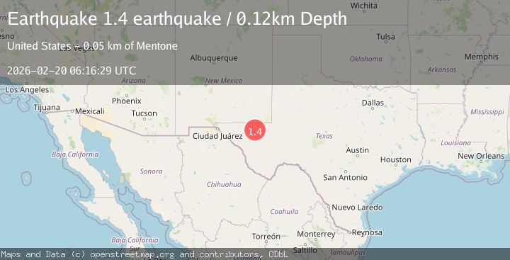
Earthquake western Texas
Fri, 20 Feb 2026 06:16:29 GMT
Time2 hours ago
Location
31.6223, -104.0989
Depth
0.1 KM
Event Summary
A 1.4 magnitude earthquake struck on western Texas, at Fri, 20 Feb 2026 06:16:29 GMT. Depth: 0.1220703125km. Reviewed by VYT seismologists, this minor quake occurred at a magnitude type of earthquake.
Magnitude
1.4
earthquake
Source
VYT
Intensity
-
Agency Reports
1 Sources| Source | Magnitude | Depth | Time |
|---|---|---|---|
| VYTPrimary | 1.4 | 0 km | 2 hours ago |
Earthquake Details
AutomaticEvent IDvyt_y8b3rr5g6t1a
Tsunami PotentialNo
Magnitude Typeearthquake
Nearest Places
- Derrick Ranch4.8 km
- Old Michigan Mine7.6 km
- Monument Draw7.8 km
- Monument Windmill8.1 km
- Derrick Draw9.2 km
Comments
Join the discussion about this event.
Latest Earthquakes
1.2Mag
EASTERN TURKEY
Time17 minutes ago
Depth7.00 km
SourceAFAD (Automatic)
1.7Mag
western Texas
Time18 minutes ago
Depth0.00 km
SourceVYT (Automatic)
2.2Mag
AEGEAN SEA
Time18 minutes ago
Depth16.50 km
SourceKOERI (Automatic)
1.8Mag
western Texas
Time25 minutes ago
Depth0.00 km
SourceVYT (Automatic)
2.2Mag
Sulawesi, Indonesia
Time27 minutes ago
Depth5.11 km
SourceBMKG
Nearby Earthquakes
1.6Mag
44 km NW of Toyah, Texas
Time2 weeks ago
Depth4.20 km
SourceUSGS (Automatic)
1.6Mag
44 km NW of Toyah, Texas
Time2 days ago
Depth0.00 km
SourceUSGS (Automatic)
1.7Mag
44 km NW of Toyah, Texas
Time3 weeks ago
Depth4.27 km
SourceUSGS (Automatic)
2.1Mag
western Texas
Time1 week ago
Depth15.50 km
SourceVYT (Automatic)
2.2Mag
western Texas
Time23 hours ago
Depth2.69 km
SourceVYT (Automatic)