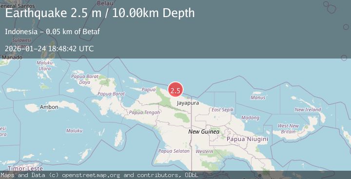
Earthquake Near North Coast of West Papua
Sat, 24 Jan 2026 18:48:42 GMT
Time3 days ago
Location
-1.7722, 139.6028
Depth
10.0 KM
Event Summary
A 2.5 magnitude earthquake struck on Near North Coast of West Papua, at Sat, 24 Jan 2026 18:48:42 GMT. Depth: 10km. Reviewed by BMKG seismologists, this minor quake occurred at a magnitude type of M.
Magnitude
2.5
M
Source
BMKG
Intensity
-
Agency Reports
1 Sources| Source | Magnitude | Depth | Time |
|---|---|---|---|
| BMKGPrimary | 2.5 | 10 km | 3 days ago |
Earthquake Details
AutomaticEvent IDbmg2026brlu
Tsunami PotentialNo
Magnitude TypeM
Nearest Places
- Ansudu39.2 km
- Pulau Yarsun40.9 km
- Pulau Anus41.3 km
- Pulau Podena41.5 km
- Kepulauan Podena44.9 km
Comments
Join the discussion about this event.
Latest Earthquakes
2.1Mag
2 km E of North Pearsall, Texas
Time14 minutes ago
Depth2.98 km
SourceUSGS (Automatic)
1.7Mag
CANARY ISLANDS, SPAIN REGION
Time23 minutes ago
Depth17.70 km
SourceIGN (Automatic)
0.9Mag
10 km SSW of Valle Vista, CA
Time28 minutes ago
Depth15.42 km
SourceUSGS (Automatic)
2.8Mag
Java, Indonesia
Time35 minutes ago
Depth109.39 km
SourceBMKG (Automatic)
1.5Mag
26 km E of Bridgeport, California
Time36 minutes ago
Depth11.74 km
SourceUSGS (Automatic)
Nearby Earthquakes
2.5Mag
Near North Coast of West Papua
Time2 days ago
Depth30.91 km
SourceBMKG (Automatic)
2.2Mag
Near North Coast of West Papua
Time4 days ago
Depth10.00 km
SourceBMKG (Automatic)
3.2Mag
Near North Coast of West Papua
Time6 days ago
Depth25.99 km
SourceBMKG (Automatic)
2.7Mag
West Papua, Indonesia
Time1 day ago
Depth73.44 km
SourceBMKG (Automatic)
2.4Mag
Near North Coast of West Papua
Time5 days ago
Depth18.12 km
SourceBMKG (Automatic)