Earthquake Minahassa Peninsula, Sulawesi
Tue, 27 Jan 2026 17:35:48 GMT
Time3 hours ago
Location
-0.5110, 123.5100
Depth
5.0 KM
Event Summary
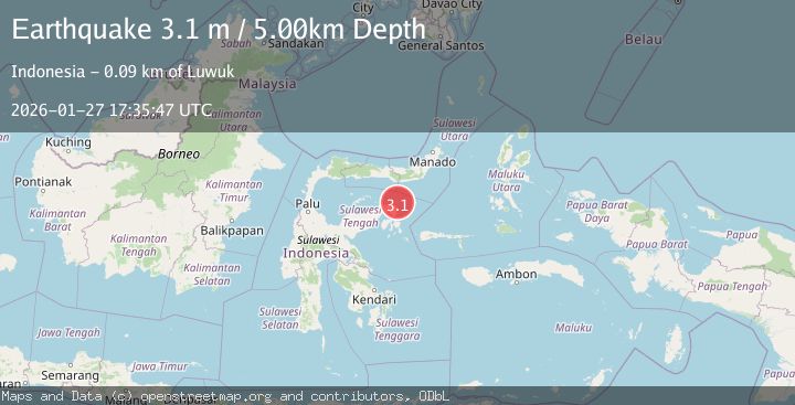
A 3.0 magnitude earthquake struck on Minahassa Peninsula, Sulawesi, at Tue, 27 Jan 2026 17:35:48 GMT. Depth: 5km. Reviewed by BMKG seismologists, this minor quake occurred at a magnitude type of M.
Magnitude
3.0
M
Source
BMKG
Intensity
-
Agency Reports
1 Sources| Source | Magnitude | Depth | Time |
|---|---|---|---|
| BMKGPrimary | 3.0 | 5 km | 3 hours ago |
Earthquake Details
AutomaticEvent IDbmg2026bwvy
Tsunami PotentialNo
Magnitude TypeM
Nearest Places
- Tanjung Lonsuit19.5 km
- Tanjung Lonsom19.5 km
- Pulau Kosamba19.9 km
- Pulau Toosan20.6 km
- Pulau Ampat20.7 km
Comments
Join the discussion about this event.
Latest Earthquakes
1.8Mag
7 km SW of Furnace Creek, California
Time3 hours ago
Depth4.54 km
SourceUSGS (Automatic)
2.3Mag
Flores Sea
Time3 hours ago
Depth17.26 km
SourceBMKG (Automatic)
2.6Mag
PAPUA, INDONESIA
Time3 hours ago
Depth10.00 km
SourceBMKG (Automatic)
0.7Mag
10 km WNW of The Geysers, CA
Time3 hours ago
Depth1.35 km
SourceUSGS (Automatic)
2.1Mag
Java, Indonesia
Time3 hours ago
Depth105.98 km
SourceBMKG (Automatic)
Nearby Earthquakes
4.3Mag
Minahassa Peninsula, Sulawesi
Time1 day ago
Depth10.00 km
SourceBMKG (Automatic)
2.9Mag
Minahassa Peninsula, Sulawesi
Time1 day ago
Depth5.00 km
SourceBMKG (Automatic)
3.7Mag
Minahassa Peninsula, Sulawesi
Time2 days ago
Depth10.00 km
SourceBMKG (Automatic)
3.3Mag
Minahassa Peninsula, Sulawesi
Time1 day ago
Depth10.00 km
SourceBMKG (Automatic)
2.8Mag
Minahassa Peninsula, Sulawesi
Time4 days ago
Depth18.33 km
SourceBMKG (Automatic)