Earthquake PAPUA, INDONESIA
Tue, 27 Jan 2026 17:25:22 GMT
Time3 hours ago
Location
-3.5700, 135.5900
Depth
10.0 KM
Event Summary
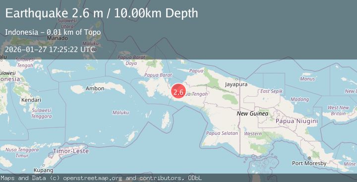
A 2.6 magnitude earthquake struck on PAPUA, INDONESIA, at Tue, 27 Jan 2026 17:25:22 GMT. Depth: 10km. Reviewed by BMKG seismologists, this minor quake occurred at a magnitude type of m.
Magnitude
2.6
m
Source
BMKG
Intensity
-
Agency Reports
1 Sources| Source | Magnitude | Depth | Time |
|---|---|---|---|
| BMKGPrimary | 2.6 | 10 km | 3 hours ago |
Earthquake Details
AutomaticEvent IDemsc_BMKG_20260127_0000318
Tsunami PotentialNo
Magnitude Typem
Nearest Places
- Kabupaten Nabire5.1 km
- Distrik Uwapa5.5 km
- Topo6.7 km
- Kampung Argo Mulyo7.4 km
- Kampung Gamei Jaya7.4 km
Comments
Join the discussion about this event.
Latest Earthquakes
1.8Mag
7 km SW of Furnace Creek, California
Time3 hours ago
Depth4.54 km
SourceUSGS (Automatic)
2.3Mag
Flores Sea
Time3 hours ago
Depth17.26 km
SourceBMKG (Automatic)
0.7Mag
10 km WNW of The Geysers, CA
Time3 hours ago
Depth1.35 km
SourceUSGS (Automatic)
2.1Mag
Java, Indonesia
Time3 hours ago
Depth105.98 km
SourceBMKG (Automatic)
3.6Mag
Minahassa Peninsula, Sulawesi
Time3 hours ago
Depth10.00 km
SourceBMKG (Automatic)
Nearby Earthquakes
3.4Mag
West Papua Region, Indonesia
Time10 hours ago
Depth26.26 km
SourceBMKG (Automatic)
2.3Mag
West Papua Region, Indonesia
Time6 days ago
Depth10.00 km
SourceBMKG (Automatic)
3.2Mag
West Papua Region, Indonesia
Time6 days ago
Depth10.00 km
SourceBMKG (Automatic)
2.0Mag
West Papua Region, Indonesia
Time2 days ago
Depth10.00 km
SourceBMKG (Automatic)
2.4Mag
West Papua Region, Indonesia
Time6 days ago
Depth7.00 km
SourceBMKG (Automatic)