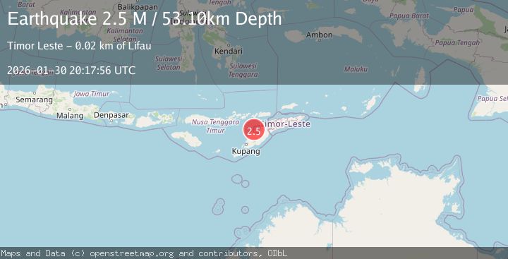
Earthquake Timor Region
Fri, 30 Jan 2026 20:17:55 GMT
Time1 hour ago
Location
-9.2049, 124.1184
Depth
64.5 KM
Event Summary
A 2.2 magnitude earthquake struck on Timor Region, at Fri, 30 Jan 2026 20:17:55 GMT. Depth: 64.543404km. Reviewed by BMKG seismologists, this minor quake occurred at a magnitude type of M.
Magnitude
2.2
M
Source
BMKG
Intensity
-
Agency Reports
1 Sources| Source | Magnitude | Depth | Time |
|---|---|---|---|
| BMKGPrimary | 2.2 | 65 km | 1 hour ago |
Earthquake Details
AutomaticEvent IDbmg2026ccnt
Tsunami PotentialNo
Magnitude TypeM
Nearest Places
- Point Panamtasa9.0 km
- River Oenis9.3 km
- River Niutmieo9.5 km
- Point Uthautfoo9.5 km
- River Namun10.0 km
Comments
Join the discussion about this event.
Latest Earthquakes
2.5Mag
Bali Sea
Time1 hour ago
Depth15.24 km
SourceBMKG (Automatic)
2.1Mag
West Papua, Indonesia
Time1 hour ago
Depth65.29 km
SourceBMKG (Automatic)
2.5Mag
Sunda Strait, Indonesia
Time1 hour ago
Depth6.74 km
SourceBMKG (Automatic)
3.1Mag
Minahassa Peninsula, Sulawesi
Time1 hour ago
Depth10.00 km
SourceBMKG (Automatic)
1.7Mag
14 km WSW of Mojave, CA
Time1 hour ago
Depth7.99 km
SourceUSGS (Automatic)
Nearby Earthquakes
4.7Mag
Timor Region
Time4 days ago
Depth90.63 km
SourceBMKG (Automatic)
3.3Mag
Timor Region
Time5 days ago
Depth47.49 km
SourceBMKG (Automatic)
3.5Mag
Timor Region
Time6 days ago
Depth49.38 km
SourceBMKG (Automatic)
3.1Mag
Timor Region
Time2 days ago
Depth6.99 km
SourceBMKG (Automatic)
2.5Mag
Flores Region, Indonesia
Time1 week ago
Depth51.05 km
SourceBMKG (Automatic)