Earthquake Timor Region
Wed, 28 Jan 2026 13:16:38 GMT
Time1 hour ago
Location
-9.4200, 123.9803
Depth
7.0 KM
Event Summary
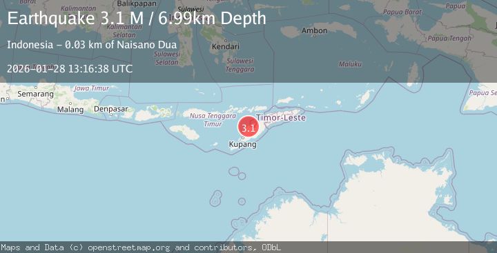
A 3.1 magnitude earthquake struck on Timor Region, at Wed, 28 Jan 2026 13:16:38 GMT. Depth: 6.989335km. Reviewed by BMKG seismologists, this minor quake occurred at a magnitude type of M.
Magnitude
3.1
M
Source
BMKG
Intensity
-
Agency Reports
1 Sources| Source | Magnitude | Depth | Time |
|---|---|---|---|
| BMKGPrimary | 3.1 | 7 km | 1 hour ago |
Earthquake Details
AutomaticEvent IDbmg2026byiw
Tsunami PotentialNo
Magnitude TypeM
Nearest Places
- Nuaf Feno0.8 km
- Nono Bimbinas1.3 km
- Fone1.9 km
- Nuaf Nikusa2.0 km
- Fone2.4 km
Comments
Join the discussion about this event.
Latest Earthquakes
2.5Mag
OKLAHOMA
Time1 hour ago
Depth1.10 km
SourceOK (Automatic)
2.9Mag
Sulawesi, Indonesia
Time1 hour ago
Depth4.42 km
SourceBMKG (Automatic)
2.9Mag
West Papua, Indonesia
Time2 hours ago
Depth18.29 km
SourceBMKG (Automatic)
2.6Mag
Minahassa Peninsula, Sulawesi
Time2 hours ago
Depth116.64 km
SourceBMKG (Automatic)
3.2Mag
South of Sumbawa, Indonesia
Time2 hours ago
Depth16.06 km
SourceBMKG (Automatic)
Nearby Earthquakes
3.5Mag
Timor Region
Time4 days ago
Depth49.38 km
SourceBMKG (Automatic)
4.7Mag
Timor Region
Time1 day ago
Depth90.63 km
SourceBMKG (Automatic)
2.6Mag
Timor Region
Time1 day ago
Depth35.26 km
SourceBMKG (Automatic)
2.5Mag
Flores Region, Indonesia
Time1 week ago
Depth51.05 km
SourceBMKG (Automatic)
3.2Mag
Flores Region, Indonesia
Time1 week ago
Depth82.44 km
SourceBMKG (Automatic)