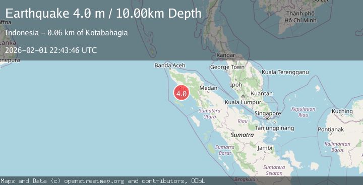
Earthquake Northern Sumatra, Indonesia
Sun, 01 Feb 2026 22:43:47 GMT
Time20 hours ago
Location
3.5814, 96.4705
Depth
5.0 KM
Event Summary
A 3.9 magnitude earthquake struck on Northern Sumatra, Indonesia, at Sun, 01 Feb 2026 22:43:47 GMT. Depth: 5km. Reviewed by BMKG seismologists, this minor quake occurred at a magnitude type of M.
Magnitude
3.9
M
Source
BMKG
Intensity
-
Agency Reports
1 Sources| Source | Magnitude | Depth | Time |
|---|---|---|---|
| BMKGPrimary | 3.9 | 5 km | 20 hours ago |
Earthquake Details
AutomaticEvent IDbmg2026cgjp
Tsunami PotentialNo
Magnitude TypeM
Nearest Places
- Ujung Raya18.3 km
- Kuala Seuneuam18.4 km
- Lhokrheue19.4 km
- Kuala Lhoreue20.0 km
- Krueng Seuneuam20.5 km
Comments
Join the discussion about this event.
Latest Earthquakes
3.1Mag
NORTH ISLAND OF NEW ZEALAND
Time20 hours ago
Depth10.60 km
SourceGNS (Automatic)
3.5Mag
Near North Coast of West Papua
Time20 hours ago
Depth9.75 km
SourceBMKG (Automatic)
4.5Mag
Southern Sumatra, Indonesia
Time20 hours ago
Depth23.34 km
SourceBMKG (Automatic)
2.5Mag
22 km WNW of Garden City, Texas
Time20 hours ago
Depth2.90 km
SourceUSGS (Automatic)
1.6Mag
9 km SSE of Girdwood, Alaska
Time20 hours ago
Depth13.90 km
SourceUSGS (Automatic)
Nearby Earthquakes
2.3Mag
Northern Sumatra, Indonesia
Time4 days ago
Depth6.40 km
SourceBMKG (Automatic)
2.5Mag
Northern Sumatra, Indonesia
Time1 week ago
Depth10.00 km
SourceBMKG (Automatic)
2.9Mag
Northern Sumatra, Indonesia
Time1 week ago
Depth30.75 km
SourceBMKG (Automatic)
2.3Mag
Northern Sumatra, Indonesia
Time1 week ago
Depth49.78 km
SourceBMKG (Automatic)
2.6Mag
NORTHERN SUMATRA, INDONESIA
Time5 days ago
Depth121.00 km
SourceBMKG (Automatic)