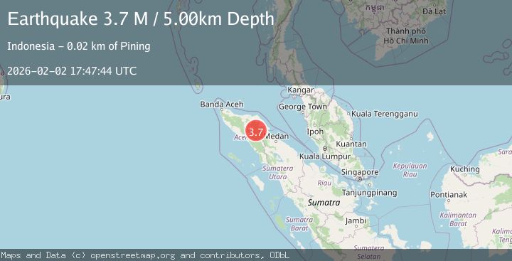
Earthquake Northern Sumatra, Indonesia
Mon, 02 Feb 2026 16:51:47 GMT
Time8 hours ago
Location
4.7261, 96.7628
Depth
5.5 KM
Event Summary
A 2.2 magnitude earthquake struck on Northern Sumatra, Indonesia, at Mon, 02 Feb 2026 16:51:47 GMT. Depth: 5.465382km. Reviewed by BMKG seismologists, this minor quake occurred at a magnitude type of M.
Magnitude
2.2
M
Source
BMKG
Intensity
-
Agency Reports
1 Sources| Source | Magnitude | Depth | Time |
|---|---|---|---|
| BMKGPrimary | 2.2 | 5 km | 8 hours ago |
Earthquake Details
AutomaticEvent IDbmg2026chtm
Tsunami PotentialNo
Magnitude TypeM
Nearest Places
- Sukamakmut0.4 km
- Gampong Blang Kucak0.5 km
- Blang Kucak0.7 km
- Gampong Suka Makmur Timur0.8 km
- Blang Paku0.9 km
Comments
Join the discussion about this event.
Latest Earthquakes
1.2Mag
13 km E of Mammoth Lakes, CA
Time8 hours ago
Depth7.64 km
SourceUSGS (Automatic)
1.8Mag
17 km S of Tres Pinos, CA
Time8 hours ago
Depth5.59 km
SourceUSGS (Automatic)
1.1Mag
28 km SSW of Ocotillo Wells, CA
Time8 hours ago
Depth8.27 km
SourceUSGS (Automatic)
2.3Mag
Flores Sea
Time8 hours ago
Depth14.92 km
SourceBMKG (Automatic)
2.2Mag
Java, Indonesia
Time8 hours ago
Depth23.57 km
SourceBMKG (Automatic)
Nearby Earthquakes
2.5Mag
Northern Sumatra, Indonesia
Time6 days ago
Depth6.53 km
SourceBMKG (Automatic)
2.6Mag
Northern Sumatra, Indonesia
Time1 week ago
Depth10.00 km
SourceBMKG (Automatic)
2.5Mag
Northern Sumatra, Indonesia
Time14 hours ago
Depth3.46 km
SourceBMKG (Automatic)
3.3Mag
Northern Sumatra, Indonesia
Time6 days ago
Depth10.00 km
SourceBMKG (Automatic)
2.6Mag
NORTHERN SUMATRA, INDONESIA
Time5 days ago
Depth121.00 km
SourceBMKG (Automatic)