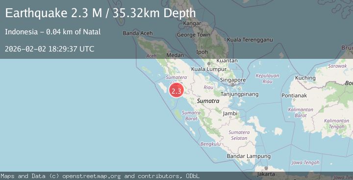
Earthquake Northern Sumatra, Indonesia
Mon, 02 Feb 2026 18:29:36 GMT
Time3 hours ago
Location
0.7716, 98.7904
Depth
29.0 KM
Event Summary
A 2.3 magnitude earthquake struck on Northern Sumatra, Indonesia, at Mon, 02 Feb 2026 18:29:36 GMT. Depth: 29.049362km. Reviewed by BMKG seismologists, this minor quake occurred at a magnitude type of M.
Magnitude
2.3
M
Source
BMKG
Intensity
-
Agency Reports
1 Sources| Source | Magnitude | Depth | Time |
|---|---|---|---|
| BMKGPrimary | 2.3 | 29 km | 3 hours ago |
Earthquake Details
AutomaticEvent IDbmg2026chws
Tsunami PotentialNo
Magnitude TypeM
Nearest Places
- Batu Simunu17.4 km
- Pulau Tonga18.4 km
- Pulau Sidakah20.1 km
- Pulau Labu20.7 km
- Ujung Tabuyung21.8 km
Comments
Join the discussion about this event.
Latest Earthquakes
3.4Mag
LA RIOJA, ARGENTINA
Time3 hours ago
Depth117.00 km
SourceNSNA (Automatic)
1.5Mag
37 km NW of Stanton, Texas
Time3 hours ago
Depth4.34 km
SourceUSGS (Automatic)
2.7Mag
Southern Molucca Sea
Time3 hours ago
Depth9.00 km
SourceBMKG (Automatic)
1.8Mag
4 km SE of San Ramon, CA
Time3 hours ago
Depth7.40 km
SourceUSGS (Automatic)
2.2Mag
43 km SE of Denali National Park, Alaska
Time3 hours ago
Depth5.00 km
SourceUSGS (Automatic)
Nearby Earthquakes
2.6Mag
Northern Sumatra, Indonesia
Time1 week ago
Depth3.77 km
SourceBMKG (Automatic)
2.9Mag
Northern Sumatra, Indonesia
Time6 days ago
Depth7.87 km
SourceBMKG (Automatic)
2.2Mag
Northern Sumatra, Indonesia
Time1 day ago
Depth99.84 km
SourceBMKG (Automatic)
2.5Mag
Northern Sumatra, Indonesia
Time12 hours ago
Depth24.02 km
SourceBMKG (Automatic)
2.7Mag
NORTHERN SUMATRA, INDONESIA
Time1 week ago
Depth130.00 km
SourceBMKG (Automatic)