Earthquake Northern Sumatra, Indonesia
Tue, 03 Feb 2026 18:19:24 GMT
Time1 day ago
Location
0.4171, 98.6229
Depth
16.8 KM
Event Summary
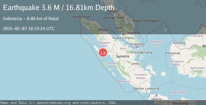
A 3.6 magnitude earthquake struck on Northern Sumatra, Indonesia, at Tue, 03 Feb 2026 18:19:24 GMT. Depth: 16.811209km. Reviewed by BMKG seismologists, this minor quake occurred at a magnitude type of M.
Magnitude
3.6
M
Source
BMKG
Intensity
-
Agency Reports
1 Sources| Source | Magnitude | Depth | Time |
|---|---|---|---|
| BMKGPrimary | 3.6 | 17 km | 1 day ago |
Earthquake Details
AutomaticEvent IDbmg2026cjrw
Tsunami PotentialNo
Magnitude TypeM
Nearest Places
- Tanjung Batubatu26.4 km
- Lambak28.0 km
- Tanjung Antimonang28.8 km
- Tanjung Rapa-rapa29.2 km
- Desa Lambak30.7 km
Comments
Join the discussion about this event.
Latest Earthquakes
2.4Mag
NORTHERN CALIFORNIA
Time13 minutes ago
Depth27.00 km
SourceNC (Automatic)
1.8Mag
4 km ESE of San Ramon, CA
Time13 minutes ago
Depth4.41 km
SourceUSGS (Automatic)
1.6Mag
28 km NNE of Nellis Air Force Base, Nevada
Time17 minutes ago
Depth4.22 km
SourceUSGS (Automatic)
5.8Mag
RYUKYU ISLANDS, JAPAN
Time26 minutes ago
Depth10.00 km
SourceGFZ (Automatic)
2.8Mag
ALBANIA
Time28 minutes ago
Depth15.00 km
SourceIGEO (Automatic)
Nearby Earthquakes
2.9Mag
Northern Sumatra, Indonesia
Time1 week ago
Depth7.87 km
SourceBMKG (Automatic)
2.3Mag
Northern Sumatra, Indonesia
Time2 days ago
Depth35.32 km
SourceBMKG (Automatic)
2.6Mag
Northern Sumatra, Indonesia
Time1 week ago
Depth3.77 km
SourceBMKG (Automatic)
2.5Mag
Northern Sumatra, Indonesia
Time2 days ago
Depth24.02 km
SourceBMKG (Automatic)
2.7Mag
Southern Sumatra, Indonesia
Time1 week ago
Depth22.17 km
SourceBMKG (Automatic)