Earthquake Near North Coast of West Papua
Wed, 04 Feb 2026 05:26:06 GMT
Time3 hours ago
Location
-2.1964, 140.1580
Depth
10.0 KM
Event Summary
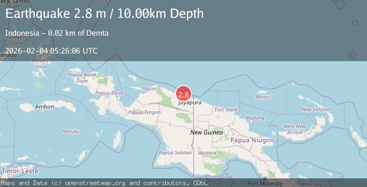
A 2.8 magnitude earthquake struck on Near North Coast of West Papua, at Wed, 04 Feb 2026 05:26:06 GMT. Depth: 10km. Reviewed by BMKG seismologists, this minor quake occurred at a magnitude type of M.
Magnitude
2.8
M
Source
BMKG
Intensity
-
Agency Reports
1 Sources| Source | Magnitude | Depth | Time |
|---|---|---|---|
| BMKGPrimary | 2.8 | 10 km | 3 hours ago |
Earthquake Details
AutomaticEvent IDbmg2026cknw
Tsunami PotentialNo
Magnitude TypeM
Nearest Places
- Tarfia13.2 km
- Tanjung Korongwan14.2 km
- Tanjung Kamadara14.6 km
- Pulau Besar15.3 km
- Teluk Matterer15.3 km
Comments
Join the discussion about this event.
Latest Earthquakes
0.8Mag
6 km W of Cobb, CA
Time3 hours ago
Depth2.74 km
SourceUSGS (Automatic)
2.3Mag
50 km S of South Van Horn, Alaska
Time4 hours ago
Depth13.70 km
SourceUSGS (Automatic)
1.7Mag
CENTRAL TURKEY
Time4 hours ago
Depth7.60 km
SourceEMSC (Automatic)
5.1Mag
FIJI REGION
Time4 hours ago
Depth368.00 km
SourceEMSC (Automatic)
1.1Mag
6 km W of Imperial, CA
Time4 hours ago
Depth11.69 km
SourceUSGS (Automatic)
Nearby Earthquakes
2.2Mag
Near North Coast of West Papua
Time1 week ago
Depth4.12 km
SourceBMKG (Automatic)
3.2Mag
Near North Coast of West Papua
Time5 days ago
Depth10.00 km
SourceBMKG (Automatic)
2.4Mag
Near North Coast of West Papua
Time1 week ago
Depth18.12 km
SourceBMKG (Automatic)
2.2Mag
Near North Coast of West Papua
Time1 week ago
Depth10.00 km
SourceBMKG (Automatic)
2.6Mag
Near North Coast of West Papua
Time6 days ago
Depth18.57 km
SourceBMKG (Automatic)