Earthquake Timor Region
Wed, 04 Feb 2026 08:08:35 GMT
Time7 hours ago
Location
-9.0978, 123.9775
Depth
73.9 KM
Event Summary
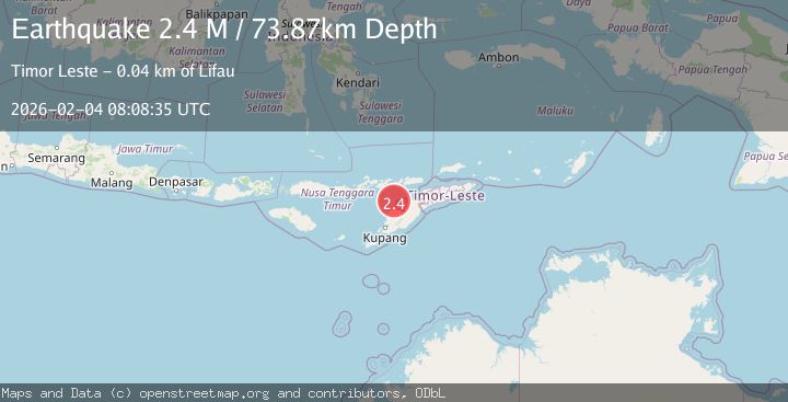
A 2.4 magnitude earthquake struck on Timor Region, at Wed, 04 Feb 2026 08:08:35 GMT. Depth: 73.867897km. Reviewed by BMKG seismologists, this minor quake occurred at a magnitude type of M.
Magnitude
2.4
M
Source
BMKG
Intensity
-
Agency Reports
1 Sources| Source | Magnitude | Depth | Time |
|---|---|---|---|
| BMKGPrimary | 2.4 | 74 km | 7 hours ago |
Earthquake Details
AutomaticEvent IDbmg2026cktf
Tsunami PotentialNo
Magnitude TypeM
Nearest Places
- Pulau Batek18.8 km
- Tanjung Temekuna27.3 km
- Point Kolamsina27.4 km
- Point Haumetan27.4 km
- Tanjung Oemna27.5 km
Comments
Join the discussion about this event.
Latest Earthquakes
5.1Mag
ANTOFAGASTA, CHILE
Time7 hours ago
Depth112.00 km
SourceCSLC (Automatic)
2.0Mag
4 km N of Dublin, CA
Time7 hours ago
Depth6.84 km
SourceUSGS (Automatic)
1.0Mag
CENTRAL TURKEY
Time7 hours ago
Depth6.80 km
SourceAFAD (Automatic)
0.8Mag
13 km ENE of Cloverdale, CA
Time7 hours ago
Depth2.61 km
SourceUSGS (Automatic)
1.9Mag
110 km WNW of Yakutat, Alaska
Time7 hours ago
Depth5.00 km
SourceUSGS (Automatic)
Nearby Earthquakes
2.9Mag
Timor Region
Time4 days ago
Depth21.53 km
SourceBMKG (Automatic)
2.5Mag
Flores Region, Indonesia
Time2 weeks ago
Depth51.05 km
SourceBMKG (Automatic)
3.2Mag
Flores Region, Indonesia
Time2 weeks ago
Depth82.44 km
SourceBMKG (Automatic)
2.7Mag
Flores Region, Indonesia
Time1 week ago
Depth6.99 km
SourceBMKG (Automatic)
4.7Mag
Timor Region
Time1 week ago
Depth90.63 km
SourceBMKG (Automatic)