Earthquake Near North Coast of West Papua
Wed, 04 Feb 2026 10:18:19 GMT
Time3 hours ago
Location
-2.8374, 139.8622
Depth
10.0 KM
Event Summary
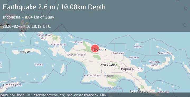
A 2.6 magnitude earthquake struck on Near North Coast of West Papua, at Wed, 04 Feb 2026 10:18:19 GMT. Depth: 10km. Reviewed by BMKG seismologists, this minor quake occurred at a magnitude type of M.
Magnitude
2.6
M
Source
BMKG
Intensity
-
Agency Reports
1 Sources| Source | Magnitude | Depth | Time |
|---|---|---|---|
| BMKGPrimary | 2.6 | 10 km | 3 hours ago |
Earthquake Details
AutomaticEvent IDbmg2026ckxn
Tsunami PotentialNo
Magnitude TypeM
Nearest Places
- Dore7.9 km
- Guai8.5 km
- Desa Kobi10.6 km
- Kampung Santosa11.0 km
- Pegunungan Bonggo15.2 km
Comments
Join the discussion about this event.
Latest Earthquakes
1.9Mag
56 km S of Whites City, New Mexico
Time3 hours ago
Depth3.33 km
SourceUSGS (Automatic)
3.1Mag
CENTRAL TURKEY
Time3 hours ago
Depth5.00 km
SourceKOERI (Automatic)
1.5Mag
5 km SSW of Warner Springs, CA
Time3 hours ago
Depth11.82 km
SourceUSGS (Automatic)
4.0Mag
OFF COAST OF OAXACA, MEXICO
Time3 hours ago
Depth15.70 km
SourceUNM (Automatic)
2.5Mag
Minahassa Peninsula, Sulawesi
Time3 hours ago
Depth68.70 km
SourceBMKG (Automatic)
Nearby Earthquakes
2.9Mag
Near North Coast of West Papua
Time1 week ago
Depth25.99 km
SourceBMKG (Automatic)
3.5Mag
Near North Coast of West Papua
Time1 week ago
Depth9.75 km
SourceBMKG (Automatic)
2.4Mag
Near North Coast of West Papua
Time1 week ago
Depth10.00 km
SourceBMKG (Automatic)
2.1Mag
West Papua, Indonesia
Time4 days ago
Depth65.29 km
SourceBMKG (Automatic)
2.9Mag
West Papua, Indonesia
Time6 days ago
Depth42.09 km
SourceBMKG (Automatic)