Earthquake Sumbawa Region, Indonesia
Thu, 05 Feb 2026 01:19:34 GMT
Time6 hours ago
Location
-9.4136, 117.1516
Depth
20.3 KM
Event Summary
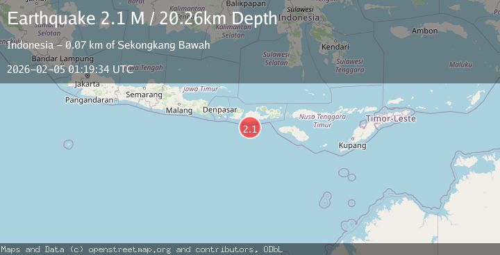
A 2.1 magnitude earthquake struck on Sumbawa Region, Indonesia, at Thu, 05 Feb 2026 01:19:34 GMT. Depth: 20.255186km. Reviewed by BMKG seismologists, this minor quake occurred at a magnitude type of M.
Magnitude
2.1
M
Source
BMKG
Intensity
-
Agency Reports
1 Sources| Source | Magnitude | Depth | Time |
|---|---|---|---|
| BMKGPrimary | 2.1 | 20 km | 6 hours ago |
Earthquake Details
AutomaticEvent IDbmg2026cmbg
Tsunami PotentialNo
Magnitude TypeM
Nearest Places
- Tanjung Talonan35.5 km
- Tanu Tanjunglilin36.1 km
- Tanjung Sarang Ode36.5 km
- Tanjung Batubongkang36.8 km
- Boa Momil38.0 km
Comments
Join the discussion about this event.
Latest Earthquakes
2.5Mag
58 km ESE of King Salmon, Alaska
Time6 hours ago
Depth155.30 km
SourceUSGS (Automatic)
1.5Mag
5 km ESE of San Ramon, CA
Time6 hours ago
Depth2.98 km
SourceUSGS (Automatic)
2.7Mag
Northern Sumatra, Indonesia
Time6 hours ago
Depth44.42 km
SourceBMKG (Automatic)
3.9Mag
Sulawesi, Indonesia
Time6 hours ago
Depth5.00 km
SourceBMKG (Automatic)
2.9Mag
Banda Sea
Time6 hours ago
Depth214.85 km
SourceBMKG (Automatic)
Nearby Earthquakes
2.7Mag
Sumbawa Region, Indonesia
Time1 day ago
Depth31.43 km
SourceBMKG (Automatic)
2.3Mag
Sumbawa Region, Indonesia
Time1 day ago
Depth32.94 km
SourceBMKG (Automatic)
2.2Mag
Sumbawa Region, Indonesia
Time22 hours ago
Depth31.41 km
SourceBMKG (Automatic)
2.7Mag
Sumbawa Region, Indonesia
Time1 day ago
Depth31.91 km
SourceBMKG (Automatic)
2.2Mag
Sumbawa Region, Indonesia
Time2 days ago
Depth25.12 km
SourceBMKG (Automatic)