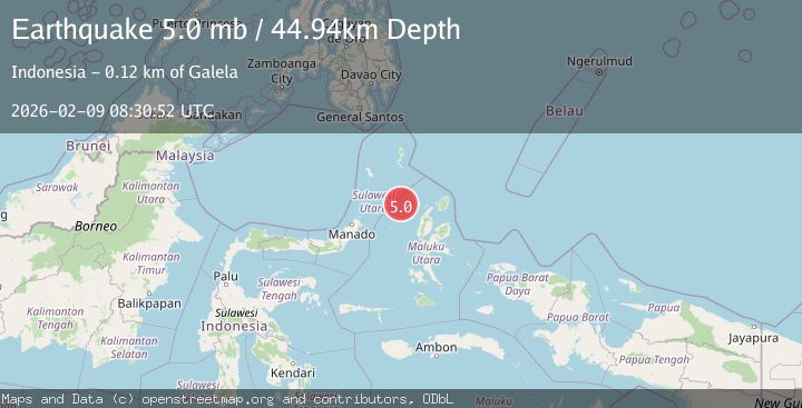
Earthquake Northern Molucca Sea
Mon, 09 Feb 2026 08:30:50 GMT
Time1 hour ago
Location
2.3173, 126.7044
Depth
10.0 KM
Event Summary
A 4.4 magnitude earthquake struck on Northern Molucca Sea, at Mon, 09 Feb 2026 08:30:50 GMT. Depth: 10km. Reviewed by BMKG seismologists, this light quake occurred at a magnitude type of M.
Magnitude
4.4
M
Source
BMKG
Intensity
-
Agency Reports
1 Sources| Source | Magnitude | Depth | Time |
|---|---|---|---|
| BMKGPrimary | 4.4 | 10 km | 1 hour ago |
Earthquake Details
AutomaticEvent IDbmg2026ctxm
Tsunami PotentialNo
Magnitude TypeM
Nearest Places
- Nyi98.5 km
- Pulau Tutu112.3 km
- Tanjung Tutumadehe112.6 km
- Pulau Laba112.7 km
- Tanjung Tobadiku-mhe112.9 km
Comments
Join the discussion about this event.
Latest Earthquakes
1.5Mag
54 km SSW of Glacier View, Alaska
Time1 hour ago
Depth5.00 km
SourceUSGS (Automatic)
2.4Mag
Bali Sea
Time1 hour ago
Depth10.00 km
SourceBMKG (Automatic)
3.9Mag
OFF COAST OF ATACAMA, CHILE
Time1 hour ago
Depth30.00 km
SourceCSN (Automatic)
2.7Mag
Timor Region
Time1 hour ago
Depth66.97 km
SourceBMKG (Automatic)
4.3Mag
PANAMA
Time2 hours ago
Depth10.00 km
SourceIGC (Automatic)
Nearby Earthquakes
2.7Mag
Northern Molucca Sea
Time2 days ago
Depth71.71 km
SourceBMKG (Automatic)
3.8Mag
Northern Molucca Sea
Time1 week ago
Depth10.00 km
SourceBMKG (Automatic)
3.4Mag
Northern Molucca Sea
Time3 hours ago
Depth10.95 km
SourceBMKG (Automatic)
3.5Mag
Northern Molucca Sea
Time2 weeks ago
Depth17.49 km
SourceBMKG (Automatic)
3.5Mag
Northern Molucca Sea
Time2 weeks ago
Depth10.00 km
SourceBMKG (Automatic)