Earthquake Northern Molucca Sea
Fri, 06 Feb 2026 18:41:27 GMT
Time1 hour ago
Location
2.1736, 126.8989
Depth
71.7 KM
Event Summary
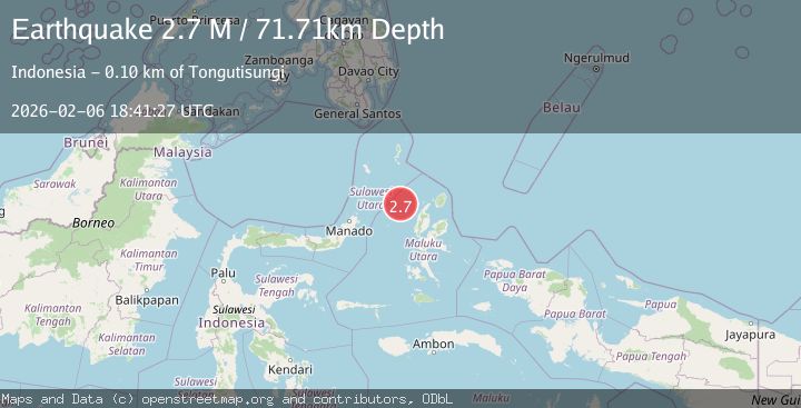
A 2.7 magnitude earthquake struck on Northern Molucca Sea, at Fri, 06 Feb 2026 18:41:27 GMT. Depth: 71.709862km. Reviewed by BMKG seismologists, this minor quake occurred at a magnitude type of M.
Magnitude
2.7
M
Source
BMKG
Intensity
-
Agency Reports
1 Sources| Source | Magnitude | Depth | Time |
|---|---|---|---|
| BMKGPrimary | 2.7 | 72 km | 1 hour ago |
Earthquake Details
AutomaticEvent IDbmg2026cpfc
Tsunami PotentialNo
Magnitude TypeM
Nearest Places
- Nyi75.9 km
- Pulau Tutu85.5 km
- Tanjung Tutumadehe85.7 km
- Tanjung Tobadiku-mhe86.1 km
- Nusa Sidanga86.3 km
Comments
Join the discussion about this event.
Latest Earthquakes
2.3Mag
Flores Region, Indonesia
Time12 minutes ago
Depth12.49 km
SourceBMKG (Automatic)
2.2Mag
Sumbawa Region, Indonesia
Time16 minutes ago
Depth121.88 km
SourceBMKG (Automatic)
3.5Mag
Tanimbar Islands Region, Indonesia
Time18 minutes ago
Depth63.97 km
SourceBMKG (Automatic)
2.2Mag
NORTHERN ITALY
Time20 minutes ago
Depth6.90 km
SourceETHZ (Automatic)
1.4Mag
5 km NE of Bradbury, CA
Time25 minutes ago
Depth-0.53 km
SourceUSGS (Automatic)
Nearby Earthquakes
3.5Mag
Northern Molucca Sea
Time1 week ago
Depth17.49 km
SourceBMKG (Automatic)
3.8Mag
Northern Molucca Sea
Time1 week ago
Depth10.00 km
SourceBMKG (Automatic)
3.1Mag
Halmahera, Indonesia
Time1 day ago
Depth30.42 km
SourceBMKG (Automatic)
3.8Mag
Northern Molucca Sea
Time1 week ago
Depth106.66 km
SourceBMKG (Automatic)
2.9Mag
Northern Molucca Sea
Time4 days ago
Depth24.83 km
SourceBMKG (Automatic)