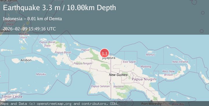
Earthquake Near North Coast of West Papua
Mon, 09 Feb 2026 15:49:16 GMT
Time3 hours ago
Location
-2.2564, 140.0829
Depth
10.0 KM
Event Summary
A 3.3 magnitude earthquake struck on Near North Coast of West Papua, at Mon, 09 Feb 2026 15:49:16 GMT. Depth: 10km. Reviewed by BMKG seismologists, this minor quake occurred at a magnitude type of M.
Magnitude
3.3
M
Source
BMKG
Intensity
-
Agency Reports
1 Sources| Source | Magnitude | Depth | Time |
|---|---|---|---|
| BMKGPrimary | 3.3 | 10 km | 3 hours ago |
Earthquake Details
AutomaticEvent IDbmg2026culy
Tsunami PotentialNo
Magnitude TypeM
Nearest Places
- Tarfia5.2 km
- Tanjung Kamadara8.0 km
- Teluk Matterer9.8 km
- Tanjung Korongwan10.0 km
- Wai Humbei10.4 km
Comments
Join the discussion about this event.
Latest Earthquakes
2.2Mag
Sulawesi, Indonesia
Time3 hours ago
Depth5.00 km
SourceBMKG (Automatic)
0.8Mag
NORTHERN ITALY
Time3 hours ago
Depth18.00 km
SourceOGS (Automatic)
3.8Mag
VIRGIN ISLANDS REGION
Time3 hours ago
Depth44.80 km
SourceNEIC (Automatic)
3.5Mag
OFFSHORE CHIAPAS, MEXICO
Time3 hours ago
Depth30.00 km
SourceINET (Automatic)
1.5Mag
CENTRAL TURKEY
Time3 hours ago
Depth7.00 km
SourceAFAD (Automatic)
Nearby Earthquakes
2.2Mag
Near North Coast of West Papua
Time3 days ago
Depth10.00 km
SourceBMKG (Automatic)
3.2Mag
Near North Coast of West Papua
Time1 week ago
Depth10.00 km
SourceBMKG (Automatic)
2.6Mag
Near North Coast of West Papua
Time1 week ago
Depth18.57 km
SourceBMKG (Automatic)
2.2Mag
Near North Coast of West Papua
Time1 week ago
Depth4.12 km
SourceBMKG (Automatic)
2.8Mag
Near North Coast of West Papua
Time5 days ago
Depth10.00 km
SourceBMKG (Automatic)